White Mountain National Forest - Mt. Morrah - September 23, 2005 - Member Trip Report
| Hike Name: | White Mountain National Forest - Mt. Morrah |
|---|---|
| Country: | United States |
| State: | New Hampshire |
| Trip Rating: |  |
| Trip Date: | September 23, 2005 |
| Duration: | 5 hours, 15 minutes |
| Trail Conditions: | Good |
| Trail Traffic: | Light |
| Trip Weather: | Partly Cloudy, Cloudy, Fog |
| Trip Winds: | Moderate |
| Trip Precipitation: | Rain |
| Trip Temperature: | High: 71-80, Low: 51-60 degrees Fahrenheit |
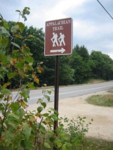
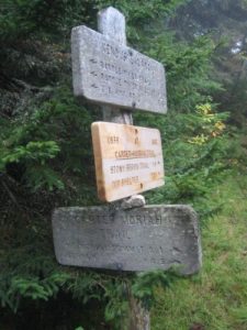
| Trip Report: | The wake up call rang out at 7am this morning, and I was packed up and on the way to McDonalds for breakfast within twenty minutes. The weatherman predicted showers this AM, and it was cloudy and overcast but dry for the most part. I parked at the trailhead and began a 3200’ climb to Mt Morrah and the Carter-Morrah Trail where Harry and I blue-blazed into Gorham during our 1994 thru-hike on 9/16/94. The short-cut only saves one mile over the Appalachian Trail, but it avoids a hitch into town on US 2. So I decided to knock off this short section of A.T. that I missed in ’94 since I was in Boston for a business trip. The first 1.6 miles to the Rattle River shelter are fairly easy and follow a gentle grade by a stream that bears the same name. A thrity-something couple had just crawled from their sleeping bags as I walked by, and the terrain got much more difficult in the next few miles. It was a steep, rocky, and occasionally boggy climb from the shelter to Mt. Morrah. I passed a female thru-hiker named Grasshopper just after I took a break at the A.T. junction with the Kenduskeag Trail and we talked briefly before I continued on to the summit of Mt. Morrah. It was blanketed by fog, mist and heavy wind when I got there but it was satisfying to make it to the top (and to get there on schedule at 10:45am in just over three hours). On the decent from Mt. Morrah, I took a short break at the A.T./Carter-Morrah Trail junction, ate a granola bar (courtesy of Delta Airlines), and finished the remainder my Nalgene water. I managed to guzzle most of the 32 oz. on the climb from U.S. 2 and had to risk a drink from the creek on the trip down. The decent was a pleasure cruise though and I spent the last 4.3 miles listening to some Widespread Panic on the IPOD. I really enjoyed the hiking above 3000 feet today, particularly among the fir trees and the bog bridges which are so characteristic of this area. By the time I made it back to the truck, the sun was out and it was a really pleasant day to be outside. I guzzed what remained of my Coke, then got lunch in Gorham at the local Subway. Some thru-hikers were milling in The Barn as I drove by and it looked like they were getting ready to hit the trail this afternoon. Man, was I envious. The drive back to Boston went smoothly and I made it to the airport by 4:30pm. Traffic was mostly outbound, and I had no issues with it. I actually made it in time to catch the 5:10pm flight, but there were only a few seats left. So I grabbed some dinner, then took the 6:10pm home and finally made it to the house around 10:30pm tonight. |


There are no comments yet.