DuPont State Forest - High Falls - Member Hike
| Hike Name: | DuPont State Forest - High Falls |
|---|---|
| Country: | United States |
| State: | North Carolina |
| Nearby Town: | Brevard |
| Rating: |  |
| Directions: | From Asheville (via Pisgah Forest): Take I-26 east to Exit 40, and take NC-280 toward Pisgah Forest. Turn left (east) on US-64 and go 3.7 miles to the Texaco station in Penrose. Turn right on Crab Creek Rd and continue 4.3 miles and turn right on DuPont Rd. Follow road for 3.1 miles. |
| Total Hike Distance: | 2.40 miles |
| Hike Difficulty: | Easy to Moderate |
| Permit Required: | No |
| Hike Type: | Roundtrip, Loop Hike |
| Hike Starts/Ends: | Hooker Falls Parking Area |
| Trails Used: | Triple Falls Trail, Galax Trail, High Falls Trail, Covered Bridge Trail |
| Backcountry Campsites: | No |
| Backcountry Water Sources: | Streams, Rivers |
| Management: | State Park Service |
| Contact Information: | DuPont State Forest NC Division of Forest Resources PO Box 300 Cedar Mountain, NC 28718 Telephone: 828-877-6527 Fax: 828-862-8531 |
| Best Season: | Winter, Spring, Summer, Fall |
| Users: | Hikers, Bikers, Dogs, Horses |
| Road Conditions: | Primary Paved Roads, Secondary Paved Roads |
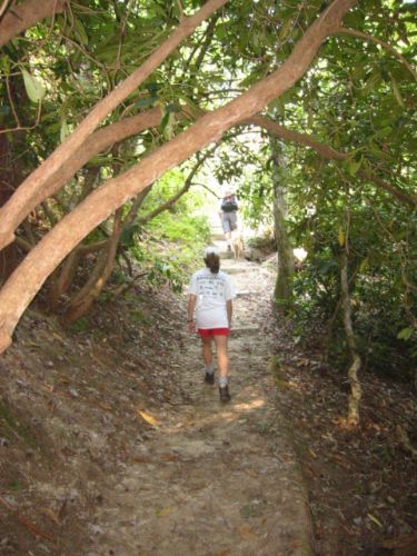
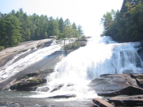
| Hike Summary: | This easy to moderate loop hike starts at the Hooker Falls Parking Area and ascends past Triple Falls to High Falls where there is a covered bridge accessible via a side trail at the top. Both falls are spectacular with access trails to their base and excellent opportunities for photographs. The Triple Falls Trail turns north just past High Falls for a pleasant loop hike that is suitable for all ages. |


Recommended

 Trail Map For This Area
Trip Reports
| Date | Rating | Duration | Hiker | |
|---|---|---|---|---|

|
June 22, 2011 |  |
4 hours | Jess F |

|
April 8, 2009 | |
3 hours | hikingdiva |

|
April 20, 2008 | |
3 hours | benps |

|
September 10, 2005 | |
2 hours | The Camel |
There are no comments yet.