John Muir Wilderness - Mott Lake - Member Hike
| Hike Name: | John Muir Wilderness - Mott Lake |
|---|---|
| Country: | United States |
| State: | California |
| Nearby Town: | Prather |
| Rating: |  |
| Directions: | From Prather, California take Hwy 168 to the next stop sign. Turn left and head up the famous "4-lane" for approximately eight miles. Then 168 narrows down again. You will go by Cressman's Store and Texaco Gas Station. This will be the cheapest place to buy gas after you leave the valley. Continue up Hwy 168 approximately six miles to Shaver Lake, which has several stores and shops (also a nice rest stop). Continue up Hwy 168 20 miles and you will pass Sierra Summit Ski Resort. As you come into Huntington Lake you will see the sign to Edison Lake (20 miles after crossing Rancheria Creek). Huntington Lake is the last chance for gas or diesel. Turn right towards Edison Lake (on the Kaiser Pass road) and head up. The road is a good two lane road for approximately six miles. Suddenly, every thing changes. This is the point you will realize why we have a T-Shirt made in honor of a road. The road is safe but can be intimidating. At this point don't be in a hurry. Remember you are on vacation and this is not a timed event. The road narrows to one lane and becomes very winding. After a couple of miles you will go over Kaiser Pass, 9128' elevation. Continue and after a few miles you will see the back country and the start of the San Joaquin drainage which appears much like Yosemite, but without the cars, traffic, or people. Continue on past a little lake called Portal Forebay. Soon you will pass the US Forest Service High Sierra Ranger Station. This is another good rest stop with restroom facilities. Approximately one more mile you will come to a Y in the road. The right fork goes to Florence Lake and the left goes to Mono Hot Springs and Edison Lake. You will continue going down hill to the left and cross the San Joaquin River to Mono Hot Springs 6500'. Now you will be heading up hill again through some steep and winding turns. After a couple of miles it will level off and you will be through the tough part. Continue on to Edison Lake and turn left at the sign at the dam. You will see a sign that says "Vermilion Valley Resort 2 miles". Cross the dam and look to your left and you can make out and see the road, and from whence came you. Follow the signs to the Resort and come on in. We'll have a cold one ready for you. (From the Vermillion Valley Ranch website: http://www.edisonlake.com/default.asp) |
| Total Hike Distance: | 13.00 miles |
| Hike Difficulty: | Very Difficult |
| Permit Required: | Yes |
| Hike Type: | In & Out, Backtrack Hike |
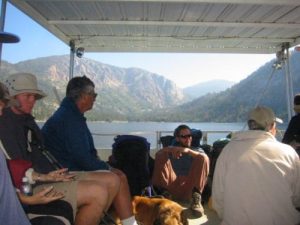
| Hike Starts/Ends: | Edison Lake (Boat Shuttle Drop Off) |
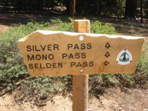
| Trails Used: | Mono Creek Trail, PCT/JMT, Mott Lake Trail |
| Backcountry Campsites: | Yes |
| Backcountry Water Sources: | Streams, Rivers, Lakes |
| Management: | U.S. Forest Service |
| Contact Information: | Sierra National Forest High Sierra Ranger District 29688 Auberry Road P.O. Box 559 Prather, CA 93651 559-855-5355 |
| Best Season: | Summer, Fall |
| Users: | Hikers, Dogs, Horses |
| Road Conditions: | Primary Paved Roads, Secondary Paved Roads, Maintained Gravel or Dirt Roads |
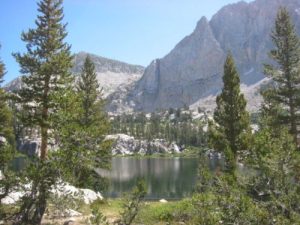
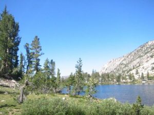
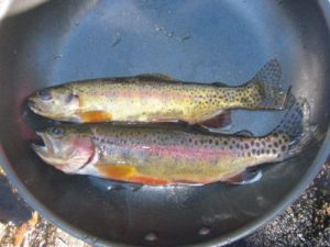
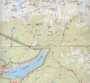
| Hike Summary: | The Sierra National Forest, located on the western slope of the central Sierra Nevada, is known for its spectacular mountain scenery and abundant natural resources. The Sierra National Forest encompasses more than 1.3 million acres between 900 and 13,986 feet in elevation. The terrain includes rolling, oak-covered foothills, heavily forested middle elevation slopes and the starkly beautiful alpine landscape of the High Sierra. This hike starts on the eastern side of Lake Edison at the shuttle drop-off ramp run by the Vermillion Valley Resort. The trail follows Mono Creek to a junction with the Pacific Crest and John Muir Trails which share the same route for 2.8 miles on this route. At pocket meadow, the hike departs the PCT/JMT and follows the Mott Lake Trail to 10040' and a beatiful alpine lake surrounded by barren High Sierra peaks. No fires are permitted above 10,000' but there is excellent trout fishing at the lake, numerous campsites, and a waterfall on the eastern edge of the shoreline. |
Recommended
Trip Reports
| Date | Rating | Duration | Hiker | |
|---|---|---|---|---|
|
August 21, 2005 |  |
1 day | WaterDog |
|
August 20, 2005 |  |
1 day | WaterDog |
|
August 19, 2005 |  |
1 day | WaterDog |
|
August 18, 2005 |  |
1 day | WaterDog |


There are no comments yet.