| Trip Report: |
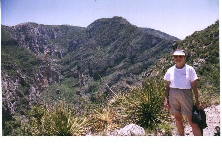
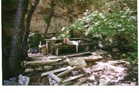
Hiked just a short part of the hike that Oshow did. Actually started at the McKittrick Canyon Visitor's Center located on Highway 62-180, seven miles north of the Pine Springs Campground. The McKitttrick Canyon trail itself is actually 10.9 miles long from the visitor center to the junction with the Tejas trail. We did a day hike and only went about half way - to a point called Turtle Rock on Mckittrick Ridge, then backtracked for a total in and out distance of about 11 miles. Really unique country -some outstanding views as well as a neat picnic area called the Grotto, with tables made from flat slabs of rock and 'Pratt Cabin' once occupied by an early settler and now used by the park service and manned by volunteers who can give a lot of interesting facts about the history of the area. |


One reply on “Guadalupe National Park - McKittrick Canyon - May 22, 2004 - Member Trip Report”
Excellent description. My family has been visitors to McKitrick Canyon for independent family hikes and with school functions. Beautiful country. Well worth the hike any season. Fall colors are fenominal the farther you travel the more majestic the colors!