| Trip Report: |
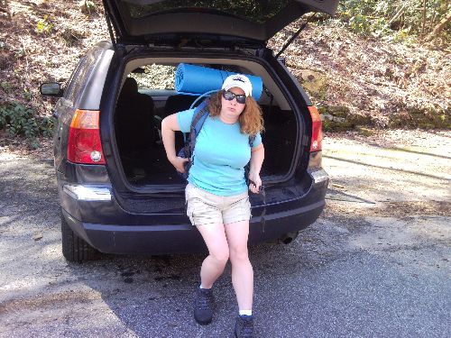
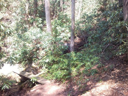
Friday 3/18 - This was the first hike for me in 20 years and the first for my wife ever. It was warm just over 80 degrees and sunny A short paved lead guides you to a picnic area with several nice tables and a very nice shelter with a rock fire place to boot! As we walked along there was several large diameter trees that ad been felled recently. At the far side of the picnic area a single sign board denotes the Chatooga River Tail 2.5 miles ahead. About two hundred feet into the trail a small Gardner snake was sitting in a sunny patch. At this point in the trail we were to the south of the East Fork of the Chatooga but only .3 miles in we crossed a bridge over the East Fork to the north side of the river. The trail stays on this side all the way until the junction of the Chatooga and the East Fork. A short time later we saw the first of many small trubutaries finding there way to the East Fork. This one has a small foot bridge to cross it. The next larger tributary has concrete stepping stones. Along the first half of this trail the East Fork remains to your left far below the trail but never out of ear shot. When the trail finally returned to the waters edge we decided to take our first break. After dropping our packs we took our shoes off and stepped intot he inviting water. WOW....was it cold. Could have only been a few degrees above freezing. Feet and legs went numb within a minute or two. After a quick snack and some water we were ready to step off again. Passes a very impressive rock wall that curves around to the left and the trail follows closely. Must have been 40 feet tall and dripped water along its length. The trail was very difficult along here due to wet muddy ground. We also encountered many logs that had fallen across the trail and required a duck under or short hop over to get by. 2.5 miles in we found the junction to the Chatooga River Trail marked by a bridge to the south over the East Fork and three sign boards. We turned south and crossed the bridge heading towards the Burrells Ford. As you step off the bridge obn the south side of the East Fork there is a very large open area with plenty of camping. There is one particularly nice one that is right on the shore of the Chatooga were the East Fork joins in. Continuing to the south and west the trail climbs up and out of the open area and finds itself above the Chatooga. We headed south rising and falling along the edge of the river but never losing site of her. There were many good campsites along the rivers edge. With less than about a half mile to go until the Burrells Ford we found our stopping place for the night. It was nice little spot a short distance off the trail and right along the edge of the Chatooga in a fast moving section with several rocks in the current making it sound very nice. We set up our tent and gathered up some firewood for the night then set about making some dinner. Dinner was Ministrone soup. Over all very good but we fixed it in a pot that was a little too small so it was rather concentrated and salty but still tasted very good! After a nice fire, and boiling some water to replinish our water supply, we went to bed for the night to the sounds of the Chatooga rippling beside us. The moon was just rising above the ridge to the east as we drifted off to sleep. Did not even need a flash light this night for a late night bathroom break due to the bright moon! The next morning we awoke, stoked a fire, and enjoyed a breakfast of coffee and oatmeal. We then broke camp and were packed and ready to go by 11AM. We headed back the same way we came headed for Ellicott Rock today. As we walked to the north we found a small snail making his way across the trail. We carefully picked him up and placed him just off the trail so nobody would step on him. After recrossing the same bridge over the East Fork we started north heading up to Ellicott Rock and keeping our eyes out for another camp site for the night. About a mile up the trail we found our spot. A small trail to the left lead us to the bank of the river along a very rocky part of the river. There was the coolest set of rock chairs here around a very nice fire ring. Someone had taken river roocks and built a recliner and a regular chair. It was very neat. We decided we could not pass this place up for the night and set up the tent. I added a nice porch and small seat right in front of our tent to cut down on dirt getting into the tent. During this process we found an orange salimander hanging out under a river rock. Pretty neat looking. We also found a red toad on the edge of the river. After setting up camp and enjoying some time along the river we decided to hike the rest of the way to Ellicot Rock. We headed north with just a water bottle and our trail guide book. The guide book said that a large bolder 8-10 feet high marked a point about 1/4 mile from the rock so we kept finding large boulders and thinking that each one of them might be this marker. After walking a while we were starting to think we had passed by it when we found some green flagging hanging from a tree branch. A quick scamper down the river bank and there it was. a 200 year old inscription of "NC" and 15 feet to the south the 198 year old Commissoners rock with the inscription "LAT 35" AD1813" "NC + SC". Think about this...with the modern GPS guides we have we are doing good to be accurate to within 15 feet but here was two seperate survey markers 200 years old and two years apart and they were 15 feet apart. Pretty impressive when you think about it! While we were here checking the rocks out a pair of hikers came along and remarked that they had been searching for the rocks but had passed right by. One of the guys was just about to take a picture of Commissoners Rock when "ploop" he dropped his cell phone right into the river....wow talk about sucking....he fished around looking for it but no avail. After he gave up his buddy gave it a shot and success....he drew it out of the water and low and behold it was still working....he had it in some sort of case that must have been water proof....i want one of those! We headed back to camp and started some supper ( a couple of Mountain house meals) and took a bath in the cold water just as the rain was begining to start. I hastily got a fire started so that it would be hot and help later if it stoped raining to get a fire going. We then climbed intot the tent and waited for the rain to subside. 15-20 minutes later we climbed out and stoked the fire and made some coffee. It sprinkled every now and then but no more rain which was good cause the bottom zipper area of our tent had started leaking and it would have been a rough night if it had kept raining! We then enjoyed the fire and some coffee and some snacks as we heard the frog we found earlier begin singing to his buddies. We turned on our flash lights and found three more frogs hanging around in the river calling back to our friend. At one point we were sitting in our rock chairs and the wife head something close by her. After turning on the flashlight she found a frog sitting right beside her....She was under attack! After laughing about the frog attck we crawled into the tent and settled down for another night of sleep. The nexy morning was much colder. A little harder to get up and moving this morning. After gathering up some more fire wood we got some breakfast going...again coffee and oatmeal....We got ourselves packed up and struck out back to the south heading back towards the East Fork Trail junction. We then turned East and headed towards the Fish Hatchery. This time it was a little more of a challange as we were climbing about 400 feet of elevation over the 2.5 miles. We found another snail along the trail as we treked along. We took a break at the concrete stepping stones and ate the rest of our snacks. A short time later we emerged from the trail. |


 Trail Map For This Area
There are no comments yet.