Sugarloaf Mountain - July 6, 2013 - Member Trip Report
| Hike Name: | Sugarloaf Mountain |
|---|---|
| Country: | United States |
| State: | Maine |
| Trip Rating: |  |
| Trip Date: | July 6, 2013 |
| Duration: | 4 hours |
| Trail Conditions: | Good |
| Trail Traffic: | Light |
| Trip Weather: | Sunny, Partly Sunny, Partly Cloudy, Cloudy |
| Trip Winds: | Light to Moderate |
| Trip Precipitation: | Rain |
| Trip Temperature: | High: 81-90, Low: 61-70 degrees Fahrenheit |
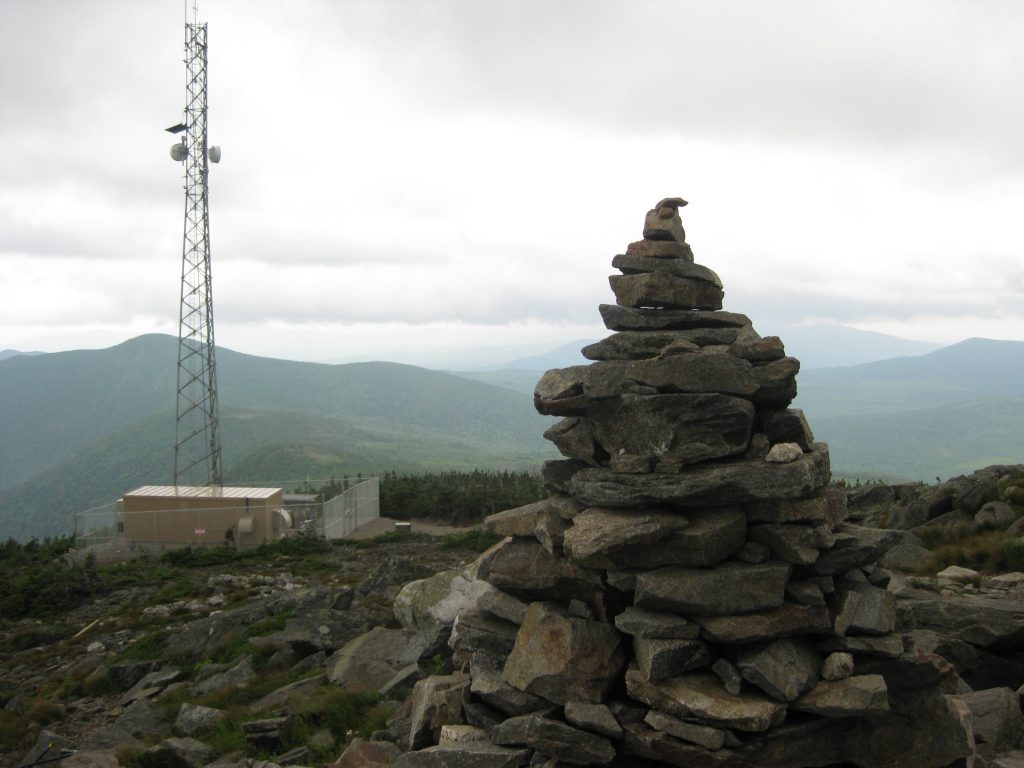
| Trip Report: | Saturday (7/06/13) – (Sugarloaf, ME) Clouds in the morning with some light rain, but clearing throughout the day to partly sunny in the afternoon and clear skies by evening. Temps cooler in the morning but warming significantly with the sun. 80’s H, 60’s L. Breezy on the mountain at times. Drove in to Stratton today to have breakfast at the White Wolf Inn where I ate with the Boyz last fall. Had a great meal, then did some shopping at a small grocery across the street. Headed back to Sugarloaf and showed the Mrs. the Caribou Pond Road and the extraction point for the hike today. (The road is only a mile from the Sugarloaf entrance.) I originally planned to have her drop me off here and hike back to Sugarloaf but we discovered that the chairlift was operating for the weekend and decided to take advantage of it. Returned to the resort around 12:30pm and got some gear and snacks together for the hike. My son decided to join me for the final stretch of my A.T. thru-hike and it was a pleasure to have him along. The Mrs. and my daughter joined us for the ride up the SuperQuad which dropped us below the Sugarloaf Summit. It was a $38 fare for the family (minus my daughter who rode free) but worth every penny because the mountain is steep to say the least. Took some family photos and hiked to the top of another chairlift that wasn’t in operation. The Mrs. turned around from here and my son and I continued the climb to the top of Sugarloaf Mountain. Arrived to find the old summit building in a complete state of disrepair, but we were able to enter and see the old stove and picnic table that I mentioned in my 1994 thru-hiking journal. I can’t believe that Boyne resorts, who bought the property a few years ago, hasn’t fixed up or town down this structure. It’s in bad shape and is only a short distance from the top of a chair lift (which may be the one that replaced to old Gondola that I stood next to for a photo in 1994). Followed the blue-blazes to a cairn that marked the summit of Sugarloaf and took a lunch break around 2pm. Beef jerky and a granola bar were on the menu. There’s a few cell towers here these days - so I wasn’t sure which one Harry stood next to in 1994 when I snapped a photo of he and Jade in the fog. My son and I had bigger issues, however, because we couldn’t figure out which way the blue-blazed trail went. After a 15 minute investigation, we finally found the route (although the map was misleading) and hiked a very tough 0.6 miles down to the junction with the A.T. Took some photos and shot some video here and fine-tuned the hiking sticks that I snagged for us on the decent. It was a 2.4 mile hike from the blue-blazed Sugarloaf Mountain trail to Caribou Pond Road, but it was very difficult. The higher elevations had wet, slippery rocks and it was a very steep decent that had me picking up well on multiple occasions. The hiking sticks were extremely helpful, but my son fell a few times and scratched and bruised himself up a bit. At one point, he was in tears but a 50+ man caught up with us after his fall and that seemed to lift his spirits – especially when he continued on down the mountain. That seemed to motivate him to pick up the pace, and we continued on with generally good spirits. Originally, I asked the Mrs. to pick us up at 2:45pm but we were only hiking about a mile an hour. So I texted her a 30 minute delay – but she never got the message. They ended up waiting about an hour at the end of Caribou Pond Road but had plenty of company as there were many day-hikers in the area this afternoon. The man who we saw earlier got word to her that we were running late, and he snapped a picture of us in the last mile as we broke in to an opening with a view. The hike from the A.T. to the parking area was longer than I remembered it, but we crossed the river with no issues and met rendezvoused with the Mrs. by 4pm. |


There are no comments yet.