Appalachian Trail Woody Gap to Unicoi Gap - July 9, 2013 - Member Trip Report
| Hike Name: | Appalachian Trail Woody Gap to Unicoi Gap |
|---|---|
| Country: | United States |
| State: | Georgia |
| Trip Rating: |  |
| Trip Date: | July 9, 2013 |
| Duration: | 3 days |
| Trail Conditions: | Good |
| Trail Traffic: | Light to Moderate |
| Trip Weather: | Partly Cloudy |
| Trip Winds: | Light |
| Trip Precipitation: | Thunderstorms |
| Trip Temperature: | High: 81-90, Low: 61-70 degrees Fahrenheit |
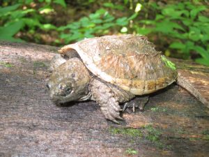
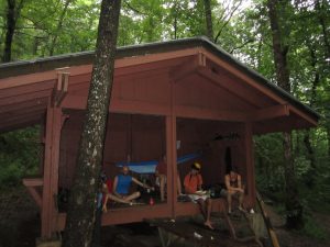
| Trip Report: | The kids are at camp Winshape for the week so it is time for Amy and I to hike another section of the AT. This time in 3 days we planned to hike from Woody Gap to Unicoi Gap which is a 30.6 mile stretch and would terminate near the town of Helen Georgia. We were a little nervous about trying to average 10 miles a day but decided that logistically it made sense. The forecast called for slightly cooler weather than is typical for Georgia with a high in the mid eighties and thunderstorms developing each night. Day 1: Amy and I left home around 7am and staged one car at Unicoi gap and then proceeded to park the other at Woody gap where we would begin the hike. We then started our adventure into the woods. The day 1 plan was to get to the Walasi-Yi shelter at Neels Gap and then either camp around the shelter, in the hostel or proceed another mile or so to Bull Gap to camp. We had talked to the Dude aka Birdshooter regarding the need for a bear canister in the area between Blood mountain and Neels Gap and decided that the bulky canister was not a good idea and to hike past the area of aggressive bear activity. As we started it was a pleasant morning with mild temperatures for Georgia in July. We AT goes up and down a few small mountains before acceding to the highest point of the trail in Georgia which is Blood Mountain. Our youngest daughter did not like the idea of us camping on top of Blood mountain through Slaughter gap and was concerned we would not return. We made it, however, to the top without incident and took a look at the shelter which was a WPA project from the 1930's. The shelter was dank and musty and had a guy in it with a very large machete laying on the ground. We were a little concerned about the machete but stayed for about half an hour to take in the scenic views from the outcropping near the shelter. The hike down was very steep and rocky, probably the hardest patch of the AT we have hiked in Georgia. We proceeded to the Walasi-Yi shelter and arrived just before the rain. The AT goes through the shelter and there is a hostel on the side building to stay if you so desire. It was 5:10pm and after buying some Poweraid we were ready to continue to Bull gap when a massive thunderstorm rolled in. The store worker left but said that we could stay under the tarp in the from of the building during the storm so we decided to cook dinner right there and wait out the rain. As we cooked and drank some "hot wine" it started really coming down hard. We talked to a man hiking with his two 20 or so year old daughters who made it to the shelter as the rain was stopping. One lightning strike hit the building or really close to it and scarred the crap out of my wife and I along with doing something to our hearts to make them skip a beat. We then discussed our options which were to stay in the hostel, bum a ride to our car and bag the hike, or to continue as planned. the rain subsided and we continued on the Bull Gap and set up camp. We made it to Bull Gap just before dusk and set up camp, 11.6 miles for the day as planned. The man with his two daughters had made camp there as well so we talked to the for awhile and went to bed. Day 2: We got up and hiking by 9am and proceeded up Levelland Mountain and across Wolf Laurel Top and Cowrock mountain aka "the Perch" where I have camped before. This section features beautiful panoramic views of North Georgia from Wolf Laurel, Cowrock and Wildcat mountains. We ate lunch on claw rock prior to climbing Wildcat mountain and followed the trail which had snails, both alive and eaten all over it. We saw many prints from small animals and also some bear paw prints in the mud. Someone before us had circled the bear print. We also discovered a 4 inch long baby snapping turtle on a log which seemed impossible that he crawled up there. We bypassed WHitley Gap shelter which is over a mile off the AT an proceeded to Low Gap shelter where we were going to eat dinner. We arrived a Low Gap shelter about 20 minutes prior to a heavy 30 minute rain and decided we were once again lucky not to get wet. We met 3 young guys, Jackalope, Rico Suave and other I don't recall from Houston who were hiking the AT for several weeks and had stayed at the Walasi-Yi hostel the night before. They told stories of mice and something large that made off with a bag of cereal bars an also feeling the jolt of lightning that hit Walasi-Yi the night before. They had also been the ones to circle the bear print, leave the turtle on the stump, and erect various cairns which we also saw. A man and his son walked in as we were eating, whom we had seen about two hours prior sitting on a vine about 10 feet above the trail. They were New Yorker's hiking for several days. The shelter looked full and we had planned on hiking a few more miles to set up camp anyway. On the way out we went past the man and his two daughters again, soaking wet again from missing the shelter by 45 minutes of so again. They were going to press on and we thought we would again camp with them. We actually went another 3 or so miles before setting up camp about 2 miles before Chattahoochee Gap. This beautiful section features many small springs and creeks coming out of the mountains and forms the beginning of the Chattahoochee river which flows into Lake Lanier which provides much of the water for greater Atlanta. We found a Really nice, small campsite directly off the trail featuring dry wood from the type of tree that I had used to make fires in periods of heavy rain before. We made a fire thinking of Jackalope and the guys who had tried for 5 days to make a fire without luck and had brought a bag of marshmallows from Houston to commemorate the moment if it ever came. Went to bed with the small fire outside the tent and slept well after hiking 14 miles that day. Day 3: Got up and ate breakfast. Amy demanded the camera to take pictures of various mushrooms and fungus that we had encouneterd during the hike. We then hiked 2 or so miles to the Chattahoochee Gap shelter where we ran into an older man from Atlanta who often hiked that section of the trail. He told us about how that shelter had been recently renovated to include an awning for better rain protection. He also described how the builders got the wood and rock on the mountain by Helicopter. He said that the trail was all downhill from here to Unicoi. I had been telling my wife the entire trip that it was all downhill from here, most likely driving her nuts so that amused me. The next section was very rocky and in fact the last mile into Unicoi Gap was steep downhill and not an easy hike with the small rocks to step over and slip on. We arrived at our van and decided to get lunch in Helen along the Chattahoochee to watch the rafters come down the river. We then proceeded to get the other van and head home after another very nice hike on the AT. |


There are no comments yet.