Grand Teton National Park - Bradley Lake - Member Hike
| Hike Name: | Grand Teton National Park - Bradley Lake |
|---|---|
| Country: | United States |
| State: | Wyoming |
| Nearby Town: | Jackson |
| Rating: |  |
| Directions: | From Downtown Jackson, WY, head north out of town to Teton Park Road and the Taggart Lake trailhead. The parking area is two miles north of the Moose Entrance Station on the Teton Park Road to the Taggart Creek parking area. |
| Total Hike Distance: | 5.90 miles |
| Hike Difficulty: | Easy to Moderate |
| Permit Required: | Yes |
| Hike Type: | Roundtrip, Loop Hike |
| Hike Starts/Ends: | Teton Park Road |
| Trails Used: | Taggart Lake, Bradley Lake, Valley, Beaver Creek Trails |
| Backcountry Campsites: | Yes |
| Backcountry Water Sources: | Streams, Lakes |
| Management: | National Park Service |
| Contact Information: | Grand Teton National Park PO Drawer 170 Moose, WY 83012-0170 (307) 739-3300 |
| Best Season: | Summer, Fall |
| Users: | Hikers, Dogs |
| Road Conditions: | Primary Paved Roads, Secondary Paved Roads |
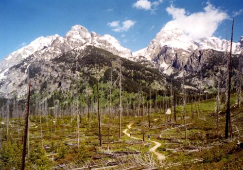
| Hike Summary: | Both Taggart Lake (6,902 feet) and Bradley Lake (7,022 feet) were named for members of the Hayden Survey party of 1872. Each was formed by glaciers flowing from the Teton Range. A glacier from Avalanche Canyon filled Taggart Lake and a glacier from Garnet Canyon filled Bradley Lake. The hike to each lake is fairly easy, and both have mature forests of lodgepole pine, Engelmann spruce, and alpine fir. The lakes also have abundant wildlife and we nearly walked into a large bull moose on our hike. This trail is located a short distance from Jackson, Wyoming and is suitable for both day and overnight hikers. |


There are no comments yet.