Devil's Lake State Park - Devil's Lake - Member Hike
| Hike Name: | Devil's Lake State Park - Devil's Lake |
|---|---|
| Country: | United States |
| State: | Wisconsin |
| Nearby Town: | Baraboo |
| Rating: |  |
| Directions: | Coming From The South: From Interstate 90-94 just take exit 106 to Highway 33. Take a right at the stop sign and go to Baraboo. (13 miles) When you get to Baraboo Take a left at the 2nd stop light. (This is Business Hwy 12) Then go through town and watch for a sign to the park. You will turn left on Highway 123 and follow it straight out to the park. Coming From The North or Wisconsin Dells: Just take Highway 12 south (Exit 92) and go about 1 mile past Baraboo (approximately 14 miles). Take a left on Highway 159. This will bring you to Highway 123. Take a right and follow into the park. |
| Total Hike Distance: | 4.00 miles |
| Hike Difficulty: | Moderate |
| Permit Required: | No |
| Hike Type: | Roundtrip, Loop Hike |
| Hike Starts/Ends: | Devil's Lake |
| Trails Used: | Ice Age Trail |
| Backcountry Campsites: | No |
| Backcountry Water Sources: | None |
| Management: | State Park Service |
| Contact Information: | Devil's Lake State Park Address: S5975 Park Road. Baraboo, WI. 53913 Park Office: 608.356.8301 Email: hesedr@dnr.state.wi.us |
| Best Season: | Fall |
| Users: | Hikers |
| Road Conditions: | Primary Paved Roads, Secondary Paved Roads |
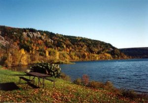
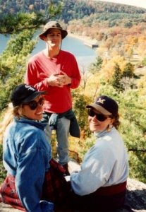
| Hike Summary: | Devil's Lake State Park has spectacular views from 500 foot cliffs, miles of hiking trails, swimming areas including two large sandy beaches, hundreds of campsites, mountain bike trails, and cross country ski trails. Part of the 1,000 mile Wisconsin Ice Age Trail also passes through the park. During our overnight visit, we hiked a moderate to difficult wooded section that runs between Parfrey's Glen and the Ice Age Loop. There are spectacular views to the south in this area and you can see the Wisconsin River in the distance. |


There are no comments yet.