Zion National Park - LaVerkin Creek Trail - Member Hike
| Hike Name: | Zion National Park - LaVerkin Creek Trail |
|---|---|
| Country: | United States |
| State: | Utah |
| Nearby Town: | Cedar City, UT |
| Rating: |  |
| Directions: | From Cedar City, UT go south on I-15 to exit 40 (Kolob Canyons). Zion National Park Visitor Center is visible from freeway. Go east to Visitor Center/Fee Station. Backcountry permits can be obtained at the visitor center. No permits are necessary for those wishing to do this trail in a day hike. Backcountry permits are required of those intending to camp one or more nights. Reservations for backcountry permits are recommended, especially for the more hospitable hiking months of September and October. July and August can be very hot and the backcountry campgrounds are not as likely to fill up. From the visitor center follow the Kolob Canyons Road up 3 miles to the Lee Pass Trailhead. The actual trailhead is about 100 yards north of the parking lot at Lee Pass. |
| Total Hike Distance: | 14.00 miles |
| Hike Difficulty: | Moderate |
| Permit Required: | Yes |
| Hike Type: | In & Out, Backtrack Hike |
| Hike Starts/Ends: | Lee Pass Trailhead |
| Trails Used: | LaVerkin Creek Trail |
| Backcountry Campsites: | Yes |
| Backcountry Water Sources: | Streams, Springs |
| Management: | National Park Service |
| Contact Information: | Zion National Park Springdale, UT 84767-1099 435-772-3256 www.nps.gov/zion |
| Best Season: | Spring, Summer, Fall |
| Users: | Hikers, Horses |
| Road Conditions: | Primary Paved Roads, Secondary Paved Roads |
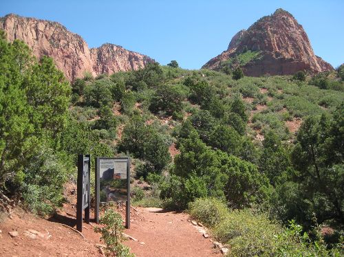
| Hike Summary: | The trail starts immediately with a downgrade, just a couple of hundred feet, but at first it is so steep that the trail is actually a set of stair steps. Then the trail climbs back up a little over 100’ and starts a steep downhill after topping the ridge. Most of the 700’ total elevational loss on this trail is done in the first mile to 1.5 mile. After coming off the ridge, the trail follows Timber Creek generally. It crosses Timber Creek or its tributaries about 20 times, but this is only a problem in the spring or right after rainstorms. Most of the rest of the year the stream is mostly dry. At 3.0 miles from the trailhead, a tributary of Timber Creek is crossed for the last time and the trail turns sharply up over a ridge that is the western extension of Gregory Butte. Up to this point, while much of the trail is open to the blazing sun, there is a lot of shade to be found under the many pine and juniper trees. The trail becomes more open on this ridge, where the vegetation is much lower, affording little shade. The trail itself is sometimes hard to follow across this ridge as it is a hardpan surface for another 1.5 miles. Once down on the south side of the ridge, the trail turns to the east to enter LaVerkin Canyon. As it approaches the canyon, the trail turns to loose red sand, which is harder to hike in. Just to the south, LaVerkin Creek will appear. Right at this point is a good place to leave the trail and hike over to the creek. The creek cascades through some picturesque rocks that also offer a great place to cool your feet (or more!) off, and the creek flows all year round. From this point the trail follows the creek into the canyon at a very gentle grade and is lined on either side by about a dozen backcountry campsites in the shade of the pines and cottonwoods. 2.5 miles into the canyon, there is a junction to the left with a short side trip trail to Kolob Arch. This trail goes into a narrow boulder-strewn canyon for a very contorted 0.5 mile to a viewpoint where one can observe the arch – at 500’ high and over 300’ wide, it is the largest natural arch in the nation. 0.25 mile beyond the Kolob Arch junction the trail has a junction to the right that climbs a ridge for about 400’ before dropping down into Hop Valley – the only trail that links the Kolob Canyons section of the park with the rest of the national park. As an alternative, the LaVerkin Creek Trail continues to the head of the canyon another 1.5 to 2.0 miles before it begins a steep and demanding climb up into Willis Creek Canyon and then it leaves the national park a mile or so beyond that. |


Recommended


Trip Reports
| Date | Rating | Duration | Hiker | |
|---|---|---|---|---|

|
July 21, 2011 |  |
2 days | gmyersut |

|
August 21, 2010 | |
12 hours, 35 minutes | gmyersut |

|
August 20, 2010 | |
11 hours | gmyersut |
One reply on “Zion National Park - LaVerkin Creek Trail - Member Hike”
Damn, UT is a beautiful place. Need to get there some time. Txs for sharing.