Sumter National Forest - Yellow Branch Falls - Member Hike
| Hike Name: | Sumter National Forest - Yellow Branch Falls |
|---|---|
| Country: | United States |
| State: | South Carolina |
| Nearby Town: | Walhalla |
| Rating: |  |
| Directions: | From Walhalla, drive west on SC 28 for 6.8 miles and turn left into the Yellow Branch Picnic Ground. |
| Total Hike Distance: | 3.00 miles |
| Hike Difficulty: | Moderate |
| Permit Required: | No |
| Hike Type: | In & Out, Backtrack Hike |
| Hike Starts/Ends: | Yellow Branch Falls Picnic Area |
| Trails Used: | Connector, Yellow Branch Falls Trails |
| Backcountry Campsites: | No |
| Backcountry Water Sources: | Streams |
| Management: | U.S. Forest Service |
| Contact Information: | Sumter National Forest Andrew Pickens Ranger District 112 Andrew Pickens Circle Mountain Rest, SC 29664 (864) 638-9568 http://www.fs.fed.us/r8/fms/ Oconee State Park (864) 638-5353 |
| Best Season: | Winter, Spring, Summer, Fall |
| Users: | Hikers, Dogs |
| Road Conditions: | Primary Paved Roads, Secondary Paved Roads |
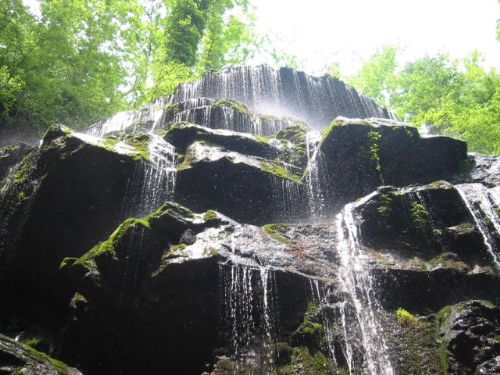
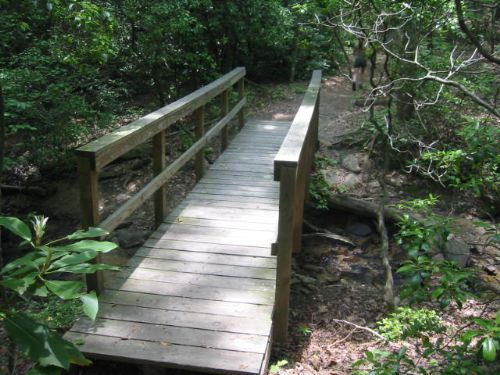
| Hike Summary: | The hike to Yellow Branch Falls is a backtrack hike over moderate terrain that ends at a beautiful 50-foot vertical waterfall with many individual cascades. The hike begins at the picnic area off of SC 28 and follows a connector trail for 0.2 miles and then joins the Yellow Branch Falls Trail for 1.3 miles to the waterfall. On the route you pass through groves of dignified hardwood and meander across a number of streams. In the winter you can see the Town of Walhalla in the distance when the trees are bare. The National Forest Service recommends that you wear sturdy shoes and use extra caution during wet conditions on this hike as the trail skirts the edges of deep ravines. |


Recommended

 Trail Map For This Area
Trip Reports
There are no Trip Reports yet.
There are no comments yet.