Pig Pen Branch #2 - Member Hike
| Hike Name: | Pig Pen Branch #2 |
|---|---|
| Country: | United States |
| State: | South Carolina |
| Nearby Town: | Mountain Rest, South Carolina |
| Rating: |  |
| Directions: | From Mountain Rest, SC Head northeast on Chattooga Ridge Rd/State Rd S-37-258 toward Hwy 28 S E 0.1 mi Turn left onto Hwy 28 S W 0.7 mi Turn right onto Village Dr 2.1 mi Turn left onto C H 50/Nicholson Ford Rd 1.1 mi Nicholson Ford Rd South Carolina 29664 |
| Total Hike Distance: | 2.20 miles |
| Hike Difficulty: | Easy to Moderate |
| Permit Required: | No |
| Hike Type: | In & Out, Backtrack Hike |
| Hike Starts/Ends: | Nicholson Ford Rd |
| Trails Used: | Foothills, Chattooga River Trails |
| Backcountry Campsites: | Yes |
| Backcountry Water Sources: | Streams, Rivers |
| Management: | National Park Service |
| Contact Information: | Sumter National Forest Andrew Pickens Ranger District 112 Andrew Pickens Circle Mountain Rest, South Carolina 29664 (864) 638-9568 |
| Best Season: | Winter, Spring, Summer, Fall |
| Users: | Hikers, Dogs, Horses |
| Road Conditions: | Primary Paved Roads, Secondary Paved Roads, Maintained Gravel or Dirt Roads |
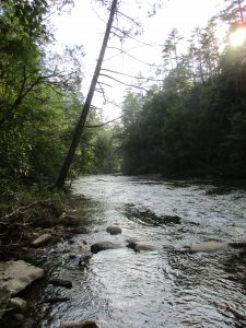
| Hike Summary: | The Chattooga River begins in the mountains of North Carolina as small rivulets, nourished by springs and abundant rainfall, high on the slopes of the Appalachian Mountains. The water drops a half mile in elevation over fifty miles as it winds its way to Lake Tugaloo where the river ends between South Carolina and Georgia. The Chattooga is one of the few remaining free-flowing streams in the Southeast, and the setting is primitive with dense forests and undeveloped shorelines on most of its route. The Chattooga River Trail is a forty mile route that borders the states of North Carolina, South Carolina, and Georgia and follows the banks of the Chattooga National Wild And Scenic River from Burrell’s Ford to US 76. Congress designated the river on May 10, 1974 and it is often used by kayakers, hikers, backpackers, and fisherman as it winds from the North Carolina mountains to Lake Tugaloo. This hike starts at the end of Nicholson Road and follows the Foothills Trail southbound down for 0.7 miles to the Chattooga River Trail. On the decent, you pass both Thrift Lake Falls and Pig Pen Branch Falls which flow in to the Chattooga. No camping is permitted at Thrift Lake Falls, but there are campsites available downstream on the river. This is the second campsite of three once you reach the river. |
Recommended
Trip Reports
There are no Trip Reports yet.


 Trail Map For This Area
There are no comments yet.