Chattooga River Trail - Ellicott Rock - Member Hike
| Hike Name: | Chattooga River Trail - Ellicott Rock |
|---|---|
| Country: | United States |
| State: | South Carolina |
| Nearby Town: | Walhalla |
| Rating: |  |
| Directions: | (Burrell’s Ford Parking Area) - From US 76/US 441 in Clayton, GA (at Wendy’s), take a right onto Rickman Road for 0.5 miles to Warwoman Road. Turn right onto Warwoman Road and head 14 miles to State Route GA 28. Take a right onto GA 28 and follow it for 1.8 miles to U.S. Forest Service Road 646 (which is also known as Burrells Ford Road). Follow USFS 646 for 9.4 miles to the Burrell Ford Parking Area. USFS 646 will turn to gravel for a majority of this drive. In South Carolina this road becomes U.S. Forest Road 708. |
| Total Hike Distance: | 6.80 miles |
| Hike Difficulty: | Easy |
| Permit Required: | No |
| Hike Type: | In & Out, Backtrack Hike |
| Hike Starts/Ends: | Burrells Ford |
| Trails Used: | Chattooga River Trail |
| Backcountry Campsites: | Yes |
| Backcountry Water Sources: | Streams, Rivers |
| Management: | U.S. Forest Service |
| Contact Information: | Sumter National Forest Andrew Pickens Ranger District 112 Andrew Pickens Circle Mountain Rest, SC 29664 (864) 638-9568 |
| Best Season: | Winter, Spring, Summer, Fall |
| Users: | Hikers, Dogs |
| Road Conditions: | Primary Paved Roads, Secondary Paved Roads, Maintained Gravel or Dirt Roads |
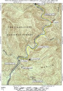
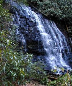
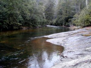
| Hike Summary: | The Chattooga River begins in the mountains of North Carolina as small rivulets, nourished by springs and abundant rainfall, high on the slopes of the Appalachian Mountains. The water drops a half mile in elevation over fifty miles as it winds its way to Lake Tugaloo where the river ends between South Carolina and Georgia. The Chattooga is one of the few remaining free-flowing streams in the Southeast, and the setting is primitive with dense forests and undeveloped shorelines on most of its route. On May 10, 1974, Congress designated the Chattooga a Wild and Scenic River - a honor reserved for rivers with outstanding scenery, recreation, wildlife, geologic, and cultural values. Ellicott Rock is along the Chattooga, and Congress established the 3,300 acre Ellicott Rock Wilderness in 1975. They made additions to the wilderness in 1984 and it now contains 9,012 acres in North Carolina, South Carolina, and Georgia. The wilderness straddles the 15,432 acre Chattooga Wild and Scenic River Corridor, providing a large undeveloped land area within easy driving distance for millions of Americans. Andrew Ellicott, a noted surveyor, was commissioned by North Carolina and Georgia to determine the boundary between the states. He completed his survey in 1811 by chiseling an inconspicuous mark on a rock on the east bank of the Chattooga River. This rock is found inside the Ellicott Rock Wilderness, and it is named Ellicott Rock after its founder. Our hike to Ellicott Rock was an easy one that followed the Chattooga River Trail and Foothills Trail northbound from the Burrells Ford Parking Area and passed the very scenic Spoon Auger Falls. Here the two trails part ways and we continued along the Chattooga River to a campsite just south of Ellicott Rock. There are numerous sites along the water, and this hike can be done as either a day or an overnight trip. |
Recommended
Trip Reports
| Date | Rating | Duration | Hiker | |
|---|---|---|---|---|

|
March 10, 2012 |  |
6 hours, 45 minutes | Jess F |

|
January 15, 2000 |  |
2 days | CC_Daphne |


 Trail Map For This Area
There are no comments yet.