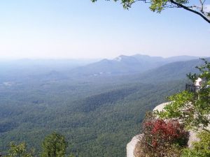
Caesar's Head State Park – The Mountain Bridge - Member Hike
| Hike Name: | Caesar's Head State Park – The Mountain Bridge |
|---|---|
| Country: | United States |
| State: | South Carolina |
| Nearby Town: | Greenville, SC |
| Rating: |  |
| Directions: | From Greenville: Take Hwy. 276 W. for about 30 mi. Park is located at the top of the mountain right off the Hwy. The North Carolina border is 3 mi. away. Long: 82° 37’ 33.32”W , Lat: 35° 6' 21.91” N |
| Total Hike Distance: | 0.17 miles |
| Hike Difficulty: | Easy |
| Permit Required: | No |
| Hike Type: | In & Out, Backtrack Hike |
| Hike Starts/Ends: | Caesar's Head State Park Visitor Center |
| Trails Used: | Mountain Bridge Trail |
| Backcountry Campsites: | No |
| Backcountry Water Sources: | None |
| Management: | State Park Service |
| Contact Information: | 8155 Geer HWY Cleveland,SC 29635 Phone: (864) 836-6115 Office Hours: 9am-5pm Park Hours: M-Su 9am-6pm (extended to 9pm during Daylight Savings Time) |
| Best Season: | Spring, Summer, Fall |
| Users: | Hikers, Dogs |
| Road Conditions: | Primary Paved Roads |
| Hike Summary: | A quick little walk across a wooden bridge to the overlook at 3250 Feet above sea level, followed by a squeeze through a rock gap about 3-4 feet wide, then a path that winds around to another overlook that also lets you look back up at Caesar's Head to see the mountain “Head” profile. |
Recommended
Trip Reports
There are no Trip Reports yet.


 Trail Map For This Area
There are no comments yet.