Latourell Falls Loop Trail - Member Hike
| Hike Name: | Latourell Falls Loop Trail |
|---|---|
| Country: | United States |
| State: | Oregon |
| Nearby Town: | Corbett, OR |
| Rating: |  |
| Directions: | From Portland, drive east on I-84 to Exit 28 (Bridal Veil). Turn Right on the Historic Highway and drive 2.8 miles to the Latourell Falls Parking lot on the left. From the east, take exit 35 (Ainsworth Park). Drive 10.8 miles west on the Historic Highway to the same lot. |
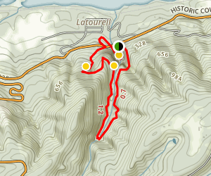
| Total Hike Distance: | 2.10 miles |
| Hike Difficulty: | Easy |
| Permit Required: | No |
| Hike Type: | Roundtrip, Loop Hike |
| Hike Starts/Ends: | Trail Head |
| Trails Used: | Latourell Falls Loop Trail |
| Backcountry Campsites: | No |
| Backcountry Water Sources: | Streams, Rivers |
| Management: | State Forest Service |
| Contact Information: | Latourell Falls Loop Trail |
| Best Season: | Spring, Summer, Fall |
| Users: | Hikers, Dogs |
| Road Conditions: | Primary Paved Roads, Secondary Paved Roads |
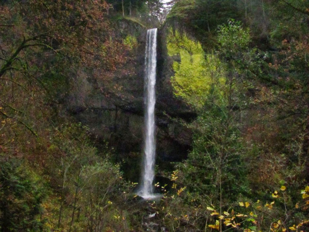
| Hike Summary: | This loop hike brings you to the base of the falls and then on a hike to the top of Latourell falls. The great thing about this hike is that it is short and it is great for all skill levels. But just because it is short don't think you should skip it altogether. It is a beautiful loop with lush greenery, it isn't very busy and the waterfall, although not the largest, is picturesque in the quiet forest setting. So bring your friends, family, kids and that friend who is unsure if they like hiking. This hike is for everyone to enjoy. |


There are no comments yet.