Hocking Hills – Rock House - Member Hike
| Hike Name: | Hocking Hills – Rock House |
|---|---|
| Country: | United States |
| State: | Ohio |
| Nearby Town: | Logan |
| Rating: |  |
| Directions: | From Logan, Ohio, head west on US-33 for approximately 5 miles before taking the County Road 33A exit toward Ohio 180. Turn left on Ohio 180 and follow it for approximately 9.3 miles and then turn left on Ohio 374. Drive another 0.8 miles and the parking area will be on the left. |
| Total Hike Distance: | 0.50 miles |
| Hike Difficulty: | Easy |
| Permit Required: | No |
| Hike Type: | In & Out, Backtrack Hike |
| Hike Starts/Ends: | Rock House Parking Lot |
| Trails Used: | Rock House Trail |
| Backcountry Campsites: | No |
| Backcountry Water Sources: | Streams |
| Management: | State Park Service |
| Contact Information: | Hocking Hills State Park 19852 State Route 664 S Logan, Ohio 43138 http://parks.ohiodnr.gov/hockinghills Park Office: (740) 385-6842 Cottage Office: (740) 385-6841 Dining Lodge: (740) 380-0400 Reservations: (866) 644-6727 |
| Best Season: | Winter, Spring, Summer, Fall |
| Users: | Hikers, Dogs |
| Road Conditions: | Primary Paved Roads |
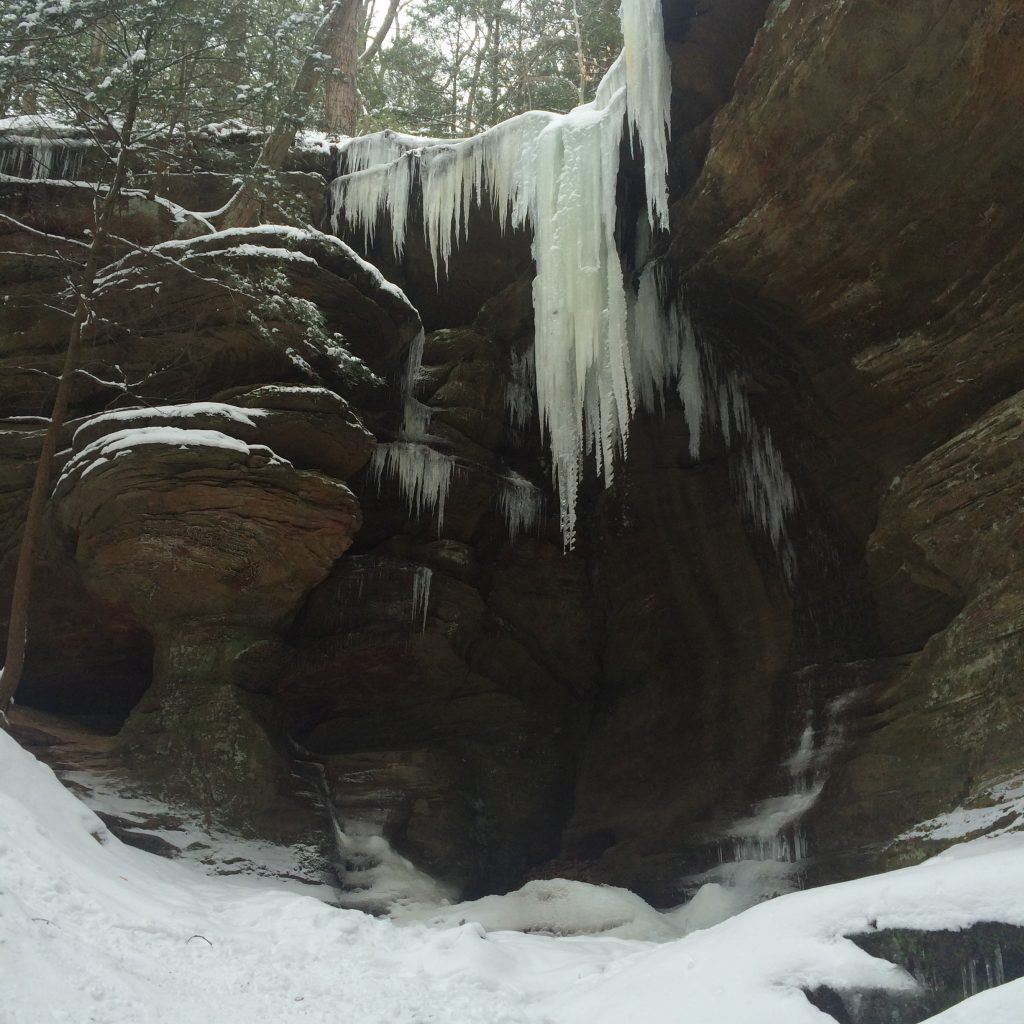
| Hike Summary: | Hocking Hills is a 2,356-acre park in southeastern Ohio, which includes numerous cliffs, caves, waterfalls and gorges. The park complex consists of six primary areas, including Rock House, Ash Cave, Cedar Falls, Old Man’s Cave, Conkle’s Hollow, and Cantwell Cliffs. This particular hike starts at the Rock House parking lot and travels counterclockwise for approximately one quarter of a mile along the Rock House Trail. The hike then backtracks out along the same route. This link provides a nice description of Rock House http://www.hockinghills.com/rock_house.html. |


2 replies on “Hocking Hills – Rock House - Member Hike”
Ha ha, they had a fire going. Does that count?
Looks like a cold hike, bro. Can’t believe you don’t have a hot liquor drink working there post hike!