Putnam Trail, Crane Mountain Pond - Member Hike
| Hike Name: | Putnam Trail, Crane Mountain Pond |
|---|---|
| Country: | United States |
| State: | New York |
| Nearby Town: | Thurman |
| Rating: |  |
| Directions: | Rt 418 to Athol Rd, bear left onto High Rd, a right turn onto Mountain/Johnsburg Valley Rd the next turn is a left onto Garnet Lake Rd, N43 32.007 W73 54.956 the second right onto Sky High Rd, the first was washed out, N43 31.564 W73 56.452 |
| Total Hike Distance: | 4.00 miles |
| Hike Difficulty: | Very Difficult |
| Permit Required: | No |
| Hike Type: | In & Out, Backtrack Hike |
| Hike Starts/Ends: | Sky High Rd N43 32.260 W73 58.066 |
| Trails Used: | Putnam Trail |
| Backcountry Campsites: | Yes |
| Backcountry Water Sources: | Streams, Lakes, Springs |
| Management: | National Park Service |
| Contact Information: | Captain John Streiff, Regional Forest Ranger P.O. Box 296 1115 State Route 86 Ray Brook, NY 12977-0296 Phone: (518) 897-1303, Fax: (518) 897-1370 Emergency Dispatch Regions 5 and 6: (518) 891-0235 |
| Best Season: | Spring, Summer, Fall |
| Users: | Hikers |
| Road Conditions: | Primary Paved Roads, Secondary Paved Roads, Maintained Gravel or Dirt Roads |
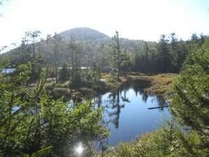
| Hike Summary: | The Putnam Trail starts out to the left of the trail head, Crane mt Trail goes off to the right. The trail starts out level for about .5 miles, crosses a stream that pours into a cave and disappears under ground. At this point the elevation is drastic, the trail climbs up a rocky ascent requiring a bit of scaling and hand climbing. The rocks and roots were found to be slippery, the utmost caution is required. The views were minimal due to leaf cover but area was nice. The trail comes into the pond and goes off to the right to several camp sites. The pond is gorgeous and worth the effort to see. |


There are no comments yet.