The Plains of San Augustine - Member Hike
| Hike Name: | The Plains of San Augustine |
|---|---|
| Country: | United States |
| State: | New Mexico |
| Nearby Town: | Magdelena |
| Rating: |  |
| Directions: | Take I-25 north from LAas Cruces to Socorro. Take New Mexico 60 west from Socorro to Datil. Take County Road 12 from Datil 15 miles southwest. At this point, you will be in the heart of the Plains of San Augustine, which is almost entirely BLM land, so hike in any direction you want. |
| Total Hike Distance: | 100.00 miles |
| Hike Difficulty: | Moderate |
| Permit Required: | No |
| Hike Type: | Roundtrip, Loop Hike |
| Hike Starts/Ends: | 15 miles southwest of Datil |
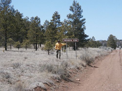
| Trails Used: | There is only one trail evident in this area, and that is the Continental Divide Trail, which crosses the Plains heading north. |
| Backcountry Campsites: | No |
| Backcountry Water Sources: | Springs, Snow |
| Management: | Bureau of Land Management |
| Contact Information: | New Mexico Office of BLM 505-438-7400 Their website is currently down for problems. No idea when it will be back up. |
| Best Season: | Winter, Spring, Fall |
| Users: | Hikers, Bikers, Dogs, Horses, ATVs |
| Road Conditions: | Primary Paved Roads, Secondary Paved Roads, Maintained Gravel or Dirt Roads |
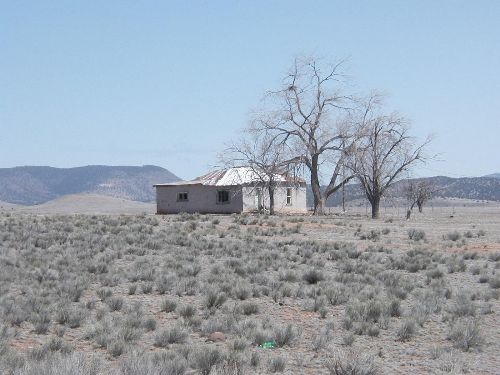
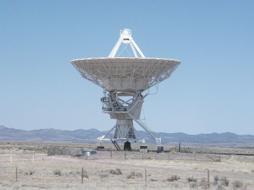
| Hike Summary: | This is a great hike for the cooler times, because Summer temperatures will be over 100 degrees. Also, the only water sources other than snow are the cattle watering ponds and tanks scattered around the area. Look for windmills to find water. The Continental Divide trail crosses the area on the east end. There are lots of abandoned ranch houses to explore and shelter in in case of bad weather. Don Diego DeVargas, the Spanish explorer, traveled extensively in this area during the reconquest of the Kingdom of New Mexico. Lots of deer, some turkey, and tons of reptiles make is a fun place to camp. There is no trail system, but cattle trails will get you anywhere you need to go. The area is mostly very flat, and on clear days you can see out to the curvature of the Earth. As a bonus, you will be able to see the VLA (Very Large Array) radio telescope system at the midpoint of your hike. I have listed the hike distance as 100 miles, since you could easily make a trip that long out of it. My trip repaort will detail our specific hike. |


There are no comments yet.