Appalachian Trail - CT/MA Border To Dalton - Member Hike
| Hike Name: | Appalachian Trail - CT/MA Border To Dalton |
|---|---|
| Country: | United States |
| State: | Massachusetts |
| Nearby Town: | Dalton |
| Rating: |  |
| Directions: | From Boston Airport 1. Start going toward the AIRPORT EXIT - go 0.1 mi 2. Continue on HOTEL DR - go 0.2 mi 3. Turn on HARBORSIDE DR - go 0.2 mi 4. Turn onto I-90 WEST toward I-90 WEST/WILLIAMS TUNNEL - go 126.2 mi 5. Take exit #2/US-20 onto HOUSATONIC ST[US-20] toward PITTSFIELD/LEE - go 1.2 mi 6. Continue to follow US-20 - go 10.5 mi 7. Continue on SOUTH ST[US-7] - go 0.2 mi 8. Turn to follow US-7 NORTH - go 0.9 mi 9. Turn on TYLER ST[RT-9] - go 0.7 mi 10. Bear to follow RT-9 - go 3.7 mi 11. Turn on HAWORTH ST - go 0.1 mi 12. Turn on STOCKBRIDGE AVE - go < 0.1 mi 13. Arrive at the center of DALTON, MA |
| Total Hike Distance: | 57.30 miles |
| Hike Difficulty: | Moderate to Difficult |
| Permit Required: | No |
| Hike Type: | One-Way, Shuttle Hike |
| Hike Starts: | CT/MA Border |
| Hike Ends: | Dalton, MA |
| Trails Used: | Appalachian Trail |
| Backcountry Campsites: | Yes |
| Backcountry Water Sources: | Streams, Rivers, Springs |
| Management: | Other |
| Contact Information: | Appalachian Mountain Club 964 South Main Street Great Barrington Massachusetts 01230 413-528-6333 http://www.ct-amc.org/ |
| Best Season: | Fall |
| Users: | Hikers, Dogs |
| Road Conditions: | Primary Paved Roads, Secondary Paved Roads, Maintained Gravel or Dirt Roads |
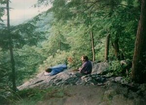
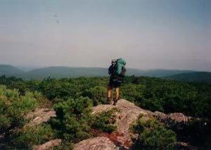
| Hike Summary: | The elevations in Massachusetts range from 650—3,491 feet, and the Appalachian Trail covers ninety miles in the state. The Connecticut and Massachusetts border is located right near Sages Ravine, a scenic area with many trees and waterfalls. Bear Rock Falls is a short distance north, and like Sages Ravine there are designated campsites in this area. We watched an incredible sunrise from the cliffs at Bear Rock Falls. From the Village of Sheffield, the Appalachian Trail climbs from US 7, crosses the Housatonic River, and heads toward the Tom Leonard and Mt. Wilcox shelters. This is a short, twenty-two mile section, but Benedict Pond is on the route and it is a nice glacial pond that has picnic tables, tent sites, and a public beach that allows swimming. Upper Goose Pond is north of Benedict Pond, and it offers some of the same services. A cabin is located on the southern edge of the pond and their is usually a summer caretaker on site in the summer. The cabin is complete with bunk beds, a stove, a dinner table, and a nice deck for lounging in front of the pond. Canoe rentals are also available. The Appalachian Trail leaves Upper Goose Pond and crosses Interstate 90 within a mile and eventually climbs to the summit of Becket Mountain at 2,180 feet. Goose Pond is seen to the south and a register box is on the tree. The overgrown summit of Walling Mountain is the next peak in this section and it is at 2,220 feet a few miles before the October Mountain shelter. The Trail then continues past the Kay Wood Lean-To and winds its way down to Dalton, a small town of around 8000 people. |


There are no comments yet.