Haleakala National Park - Pa Kaoao Trail - Member Hike
| Hike Name: | Haleakala National Park - Pa Kaoao Trail |
|---|---|
| Country: | United States |
| State: | Hawaii |
| Nearby Town: | Makawao |
| Rating: |  |
| Directions: | The Summit area of Haleakala is a three hour round trip drive from Kahului via roads 37, 377, and 378. Follow the signs posted along the Highway. |
| Total Hike Distance: | 0.50 miles |
| Hike Difficulty: | Moderate |
| Permit Required: | No |
| Hike Type: | In & Out, Backtrack Hike |
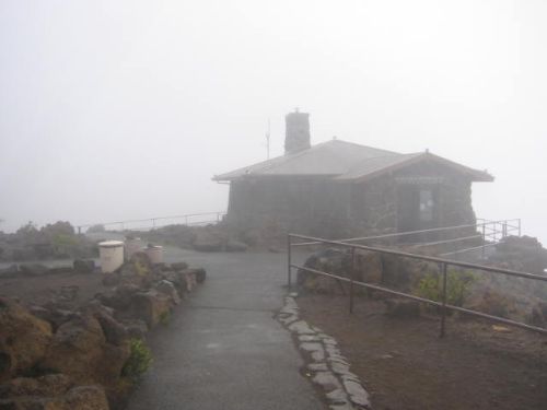
| Hike Starts/Ends: | Haleakala Visitor's Center |
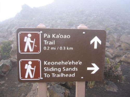
| Trails Used: | Pa Kaoao Trail |
| Backcountry Campsites: | No |
| Backcountry Water Sources: | None |
| Management: | National Park Service |
| Contact Information: | Haleakala National Park P.O. Box 369 Makawao, Maui, HI 96768 Visitor Information 808.572.4400 Headquarters 808.572.4400 |
| Best Season: | Winter, Spring, Summer, Fall |
| Users: | Hikers |
| Road Conditions: | Primary Paved Roads, Secondary Paved Roads |
| Hike Summary: | A short trail (less than .5 mile or .8km round trip) leads to the top of Pa Kaoao, a small cinder cone. This is one of the highest vantage points in the park and this trail offers excellent views of the Wilderness Area. Stone shelters built by the early Hawaiians that explored Haleakala long ago are still visible from the trail. The trail starts just outside of the Haleakala Visitor Center (at 9,740 feet or 2969m). |


There are no comments yet.