Chattahoochee National Forest - Toccoa River - Member Hike
| Hike Name: | Chattahoochee National Forest - Toccoa River |
|---|---|
| Country: | United States |
| State: | Georgia |
| Nearby Town: | Suches |
| Rating: |  |
| Directions: | Take US 19/GA 60 north for 9 miles. Bear left on GA 60, where US 19 turns right. Continue another 7 miles to Suches, GA. From the intersection of GA 180 and GA 60 in Suches, continue north on GA 60 for another 14.8 miles to the GA 60 trailhead. Roadside parking is along the right side of the road, just beyond the trail crossing. |
| Total Hike Distance: | 5.60 miles |
| Hike Difficulty: | No Answer |
| Permit Required: | No |
| Hike Type: | One-Way, Shuttle Hike |
| Hike Starts: | GA 60 |
| Hike Ends: | GA 60 |
| Trails Used: | Benton Mackaye Trail/Duncan Ridge Trail, USFS 816 |
| Backcountry Campsites: | Yes |
| Backcountry Water Sources: | Rivers |
| Management: | U.S. Forest Service |
| Contact Information: | Chattahoochee National Forest Toccoa Ranger District 6050 Appalachian Highway Blue Ridge, GA 30513 Phone: 706 632-3031 http://www.fs.fed.us/conf/ |
| Best Season: | Winter, Spring, Summer, Fall |
| Users: | Hikers, Dogs |
| Road Conditions: | Primary Paved Roads, Secondary Paved Roads |
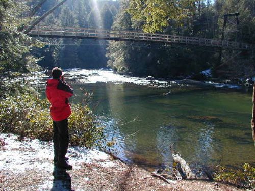
| Hike Summary: | The Benton MacKaye Trail and the Duncan Ridge Trail share this in-and-out backtrack route between GA 60 and the Toccoa River and the highlight of this section is an impressive suspension bridge over the river. The Georgia Appalachian Trail Conference and the U.S. Forest Service constructed the 260’ bridge in 1977, and it offers an excellent view of the Toccoa River in both directions. The trail begins near Tooni Gap located on GA 60 at 2,028 feet, and the path heads southbound over Tooni Mountain toward the river. In the first mile, the Benton MacKaye and Duncan Ridge Trails make an ascent of nearly 600 feet up Tooni Mountain (sometimes referred to as Toonowee Mountain on older maps). Tooni Mountain is actually a series of small knobs across a long ridgeline with elevations that range from 2,396 to 2,720 feet. The result is a bouncy ride for hikes and their dogs as they traverse these knobs before the Benton MacKaye and Duncan Ridge Trails make their final descent after 3.5 miles to the Toccoa River at 1,920 feet. At the water, the trail meets the first of several campsites and turns to the right toward the Toccoa River suspension bridge. The gravel Forest Road 816 can be used to save some time and effort on the return trip since it has very little elevation change as it winds back to Tooni Gap. |


Recommended


Trip Reports
| Date | Rating | Duration | Hiker | |
|---|---|---|---|---|

|
October 27, 2007 |  |
1 day | mark502 |

|
February 5, 2000 | |
2 days | The Kidd |
One reply on “Chattahoochee National Forest - Toccoa River - Member Hike”
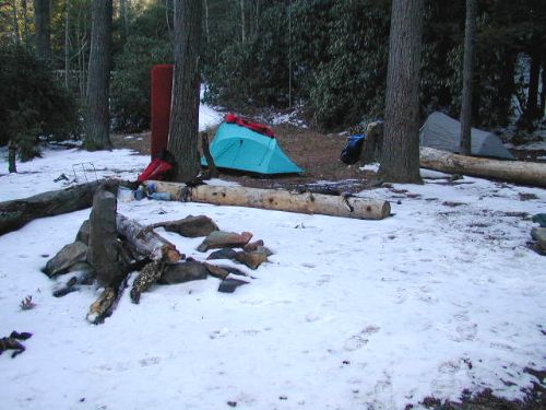
The Forest Service has closed some of the campsites near the suspension bridge due to overuse and abuse. There are still some in the area, but the one marked on the TOPO map for the Toccoa River hike may no longer be available.