Chattahoochee National Forest - Rabun Bald - Member Hike
| Hike Name: | Chattahoochee National Forest - Rabun Bald |
|---|---|
| Country: | United States |
| State: | Georgia |
| Nearby Town: | Clayton |
| Rating: |  |
| Directions: | (Beegum Gap, 1.4 Miles From Rabun Bald) - From Clayton, Georgia, start at the junction of U.S. 76 and U.S. 441, and head north for 8.0 miles. Before the North Carolina border, turn right onto GA 246 where there is a gas station and a sign pointing toward Sky Valley. Drive for 4.3 miles on GA 246 to its junction with Old Mud Creek road. (You will cross into North Carolina briefly on this road.) There is a small restaurant located where GA 246 meets Old Mud Creek Road. Turn right at the restaurant onto Old Mud Creek Road and drive 2.9 miles to Kelsey Mountain Road. Here you’ll see a USFS sign for Rabun Bald. Turn right onto Kelsey Mountain Road and drive 0.9 miles to Beegum Gap. The paved road ends here after 0.9 miles and there are a number of houses in this area. Many people park at the base of the 4x4 road located at Beegum Gap. Do not park any where else since most of this area is private property. It is 1.1 miles up this 4x4 to Rabun Gap. You can also walk about 100 yards to the left of the 4x4 road past a house and intersect with the Bartram Trail. Turn right onto the Bartram Trail and follow it for a more secluded hike to Rabun Gap. (Rabun Gap, 0.7 Miles From Rabun Bald) - To reach Rabun Gap (which is about a mile from the summit of Rabun Bald) follow the directions to Beegum Gap. It is a 1.1 mile hike up the 4x4 road to Rabun Gap. If you have four wheel drive, the road is rocky but passable. However, taking a 4x2 vehicle up this road is not recommended, especially if it is a low clearance vehicle. |
| Total Hike Distance: | 1.40 miles |
| Hike Difficulty: | Moderate |
| Permit Required: | No |
| Hike Type: | In & Out, Backtrack Hike |
| Hike Starts/Ends: | Rabun Gap |
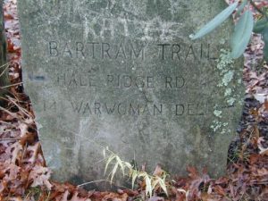
| Trails Used: | Bartram Trail |
| Backcountry Campsites: | Yes |
| Backcountry Water Sources: | None |
| Management: | U.S. Forest Service |
| Contact Information: | Chattahoochee National Forest 508 Oak Street NW Gainesville, GA 30501 (404) 536-0541 |
| Best Season: | Winter, Spring, Summer, Fall |
| Users: | Hikers, Dogs |
| Road Conditions: | Primary Paved Roads, Secondary Paved Roads, Maintained Gravel or Dirt Roads, Unmaintained Gravel or Dirt Roads |
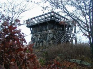
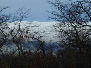
| Hike Summary: | The hike to Rabun Bald is one of my most favorite destinations in the Southeast. The view from the firetower is outstanding, and on July 4th you can watch fireworks from three small communities near the trailhead. You have an option of taking a one, two, or four mile route to the summit, but there is no water at the tower, and we recommend that you carry it with you. In the spring or fall it can get very cold on Rabun Bald, so it’s best to take winter gear, even in the summer. |
Recommended
Trip Reports
| Date | Rating | Duration | Hiker | |
|---|---|---|---|---|

|
October 18, 2005 |  |
2 days | Bam-Bam |
|
November 16, 2001 |  |
2 days | Candy A |
|
November 10, 2002 |  |
2 days | The Camel |


There are no comments yet.