Bartram Trail - Member Hike
| Hike Name: | Bartram Trail |
|---|---|
| Country: | United States |
| State: | Georgia |
| Nearby Town: | Dilliard |
| Rating: |  |
| Directions: | Located just 15 miles from Franklin North Carolina and a short drive from Rt. 441. Take 441 south from Franklin to the Georgia border. Keep your eyes open for Ga.State Rd. 246. Turn left here and travel 4 miles to mud dude rd in the village of Sky Valley. Turn right on mud rd. travel 2 miles past vacation homes. On the right you will see a brown and yellow Forest Service sign that says "hiking trail". In small letters below that you will see Rabun Bald. Turn right on this road and follow it one tenth of a mile to the end. The trail head is at the end of the road. |
| Total Hike Distance: | 15.00 miles |
| Hike Difficulty: | Moderate |
| Permit Required: | No |
| Hike Type: | One-Way, Shuttle Hike |
| Hike Starts: | Beegum Gap |
| Hike Ends: | Warwoman Dell Picnic Area |
| Trails Used: | Bartram |
| Backcountry Campsites: | Yes |
| Backcountry Water Sources: | Streams |
| Management: | None |
| Contact Information: | Unknown |
| Best Season: | Winter, Spring, Summer, Fall |
| Users: | Hikers |
| Road Conditions: | Secondary Paved Roads |
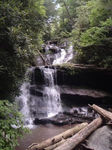
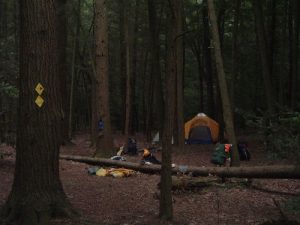
| Hike Summary: | Hiked to Rabun Bald, then continued south on the Bartram trail To Warwoman Dell, Several good views and two nice waterfalls, one with a very nice large campsite. |
Recommended
Trip Reports
There are no Trip Reports yet.


There are no comments yet.