Appalachian Trail - Springer Mountain (via Nimblewill Gap) - Member Hike
| Hike Name: | Appalachian Trail - Springer Mountain (via Nimblewill Gap) |
|---|---|
| Country: | United States |
| State: | Georgia |
| Nearby Town: | Dahlonega |
| Rating: |  |
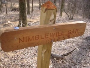
| Directions: | From the intersection of GA 400N and US19/GA 60, turn onto US19/GA 60 and head west for 9.3 miles toward Dahlonega and the junction of GA9/GA52. Turn left onto GA9/GA52 and drive 4.3 miles. Here GA 52 breaks from GA 9, so turn right onto GA 52 and continue 7.1 miles to the second sign for Nimblewill Church Road. (There are two signs for Nimblewill Church Road along GA 52 to provide two access points to the church.) At the second sign for Nimbellwill Church Road, turn right and head 1.2 miles to Nimblewill Church. At the stop sign, turn left and head away from the church and up Nimblewill Gap Road which turns to gravel after a few miles. Follow this road 7.3 miles to Nimblewill Gap. The road is rutted and rocky in parts and a high clearance vehicle is mandatory for this area. |
| Total Hike Distance: | 5.00 miles |
| Hike Difficulty: | Moderate to Difficult |
| Permit Required: | No |
| Hike Type: | In & Out, Backtrack Hike |
| Hike Starts/Ends: | Nimblewill Gap - USFS 28 |
| Trails Used: | The Approach, Appalachian Trails |
| Backcountry Campsites: | Yes |
| Backcountry Water Sources: | Streams, Springs |
| Management: | U.S. Forest Service |
| Contact Information: | Chattahoochee National Forest 508 Oak Street NW Gainesville, GA 30501 (404) 536-0541 |
| Best Season: | Winter, Spring, Summer, Fall |
| Users: | Hikers, Dogs |
| Road Conditions: | Primary Paved Roads, Secondary Paved Roads, Maintained Gravel or Dirt Roads, Unmaintained Gravel or Dirt Roads |
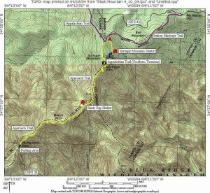
| Hike Summary: | Springer Mountain is located in the Chattahoochee National Forest, and it is the southern terminus of the Appalachian Trail. Every spring, 2000-3000 thru-hikers (or individuals that plan to hike the entire A.T. in a single year) leave from the summit of Springer to attempt a 2100+ mile journey to the northern terminus at Mt. Katahdin in Maine. Springer Mountain (3,782 feet) has a bronze plaque (showing a hiker facing north) that is set in stone next to the first white blaze marking the Appalachian Trail. There is also a terminus plaque set in a rock behind the blaze that has a compartment with a trail register of entries from day hikers, backpackers, and thru-hikers that have visited the area. This hike approaches Springer Mountain from Nimblewill Gap at USFS 28 and makes a gradual climb to the summit passing the Black Shelter on the way at 3410 feet. |
Recommended
Trip Reports
| Date | Rating | Duration | Hiker | |
|---|---|---|---|---|

|
April 11, 2004 |  |
1 day | BirdShooter |

|
April 10, 2004 |  |
1 day | BirdShooter |

|
March 23, 2007 |  |
1 day | BirdShooter |

|
March 22, 2007 |  |
1 day | BirdShooter |


One reply on “Appalachian Trail - Springer Mountain (via Nimblewill Gap) - Member Hike”
Homeless people livin in campground very trashy and nasty would be great place for inmates in prison to work cleaning up the place