Islip Saddle to Mt. Williamson, Pleasant View Ridge - Member Hike
| Hike Name: | Islip Saddle to Mt. Williamson, Pleasant View Ridge |
|---|---|
| Country: | United States |
| State: | California |
| Nearby Town: | La Canada-Flintridge |
| Rating: |  |
| Directions: | Ca HWY2 Angeles Crest) 40 miles from La Canada-Flintridge |
| Total Hike Distance: | 5.50 miles |
| Hike Difficulty: | Moderate |
| Permit Required: | No |
| Hike Type: | In & Out, Backtrack Hike |
| Hike Starts/Ends: | Islip Saddle, PCT Trailhead |
| Trails Used: | Pacific Crest Trail From Islip Saddle, Mount Williamson Trail, Some cross country on pleasant view ridge |
| Backcountry Campsites: | No |
| Backcountry Water Sources: | None |
| Management: | U.S. Forest Service |
| Contact Information: | Angeles National Forest 701 N. Santa Anita Avenue Arcadia, CA 91006 626-574-1613 www.r5.fs.fed.us/angeles |
| Best Season: | Winter, Spring, Fall |
| Users: | Hikers |
| Road Conditions: | Primary Paved Roads |
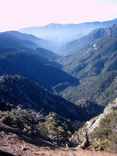
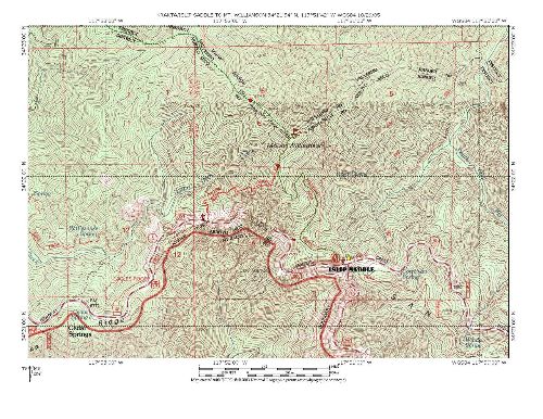
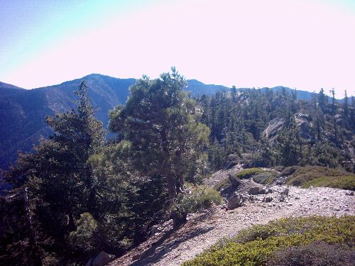
| Hike Summary: | #65 In John W. Robinson's "Trails Of The Angeles" 1600' Elevation Gain/Loss June-Oct. This hike starts at either of two points off Angeles Crest, using the Pacific Crest trail. I chose to take the trail up from Islip Saddle. You can also begin at the PCT trailhead just beyond Kratka ridge ski area near highway mileage marker 62.50. From Islip saddle, park in PCT lot (clearly marked). Start up trail at NW corner of lot just behind restrooms. From the trailhead follow the well maintained PCT 2 miles. The trail rises steadily to a junction. From here you get a beautiful view of bear canyon and the south facing slope of Mt. Williamson. From the junction turn right (N) and follow a sometimes steep, narrow trail up to the “summit” of Mt. Williamson (8214’). From here you can see Mt. Lewis, and Throop peak to the east, and Mt. Islip, and Mt. Hawkins to the south. On clear days you can look beyond bear canyon to Palos Verdes, and Catalina Island. North of the mapped summit, approx 0.25 miles along the ridge is there a higher bump at 8244’ this is where the best view are. The trail is a bit loose and thin in spots, so be cautious. This is where you’ll find the register. The views here are a bit more broad, with excellent views of Mt. Waterman, and Twin Peaks to the SW, The San Andreas rift Zone N, NE, and glimpses of The Devil’s Punchbowl deep in the canyon. I was able to see across the desert and just glimpse the saw tooth pattern of the Southern Sierras. From here you can continue down pleasant view ridge for even more unbelievable views however the trail beyond the register is rough. Because of the Treacherous terrain and remoteness of the area it is not advisable to go alone beyond the bump. Return the way you came. |


There are no comments yet.