Joyce Kilmer–Slickrock Creek Wilderness - Stratton Bald - Member Hike
| Hike Name: | Joyce Kilmer–Slickrock Creek Wilderness - Stratton Bald |
|---|---|
| Country: | United States |
| State: | North Carolina |
| Nearby Town: | Robbinsville |
| Rating: |  |
| Directions: | (Wolf Laurel Parkin Area) – From Robbinsville, NC take US 129 north approximately 1 mile past Robbinsville. Turn left onto NC 143 West (marked with a sign for the Joyce Kilmer – Slickrock Creek Wilderness). After 3.4 miles, NC 143 West makes a 90 degree turn to the right. Continue on NC 143 West for 10.2 miles to Santeetah Gap. This is the junction of NC 143, FR (Forest Road) 81, and SR (State Road) 1127. There is a wayside station here on NC 143. Immediately before the wayside station, turn right onto SR 1127, and then make an immediate left onto FR 81. FR 81 is a U.S. Forest Service Road and within 100 yards it changes from pavement to gravel. Continue on FS 81 for 6.7 miles. You will pass a number of drive-in campsites along the creek. Watch carefully for FR 81F. This road breaks off to the right. Follow FR 81F for 4.8 miles to the Wolf Laurel Trailhead. |
| Total Hike Distance: | 4.20 miles |
| Hike Difficulty: | Moderate |
| Permit Required: | No |
| Hike Type: | In & Out, Backtrack Hike |
| Hike Starts/Ends: | Wolf Laurel Parking Area |
| Trails Used: | Wolf Laurel Access Trail, Stratton Bald Trail |
| Backcountry Campsites: | Yes |
| Backcountry Water Sources: | Springs |
| Management: | U.S. Forest Service |
| Contact Information: | Nantahla National Forest Cheoah Ranger District Route 1, Box 16-A Robbinsville, NC 28771 (704) 479-6431 |
| Best Season: | Spring, Summer, Fall |
| Users: | Hikers, Dogs |
| Road Conditions: | Primary Paved Roads, Secondary Paved Roads, Maintained Gravel or Dirt Roads, Unmaintained Gravel or Dirt Roads |
| Hike Summary: | Joyce Kilmer–Slickrock Creek Wilderness was designated with the passage of the 1975 Wilderness Act and expanded in size in 1984 with the North Carolina Wilderness Act. The 17,013 acres of forest shares a common boundary along the Unicoi Mountains with the Citico Creek Wilderness in the Cherokee National Forest in Tennessee, but the majority of land is in the Nantahala National Forest in North Carolina. Although the wilderness is best known for the gigantic strands of virgin timber in the Poplar Cove area, the high elevation areas including Stratton Bald and Hangover offer fantastic views of the surrounding Cherokee and Nantahala National Forests. Both areas exceed 5000 feet and offer dramatic 270-360 degree views. This hike to Stratton Bald is a moderate but short hike that starts at the Wolf Laurel Trailhead and climbs to an open meadow on top of Stratton Bald with excellent views of North Carolina to the south and Tennessee to the west. |
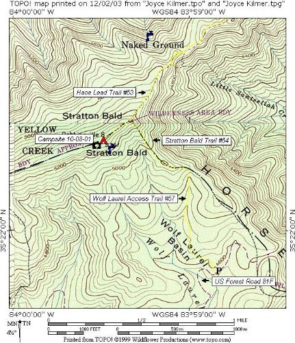


 Trail Map For This Area
2 replies on “Joyce Kilmer–Slickrock Creek Wilderness - Stratton Bald - Member Hike”
If you approach Stratton Bald from the Wolf Laurel Parking Area, the spring is on your left and slightly down the ridge line when you first reach the clearing with Stratton Bald directly ahead. There will be 6 large Balsalm Firs on your left and the spring is directly down the hill from them. It runs slowly but is fairly reliable.
Great hikes. I’ve stayed here two times, but have never been able to find the spring. If you know where it is, please respond. Thanks.