Uinta National Forest - Mill Canyon Peak Loop - July 9, 2010 - Member Trip Report
| Hike Name: | Uinta National Forest - Mill Canyon Peak Loop |
|---|---|
| Country: | United States |
| State: | Utah |
| Trip Rating: |  |
| Trip Date: | July 9, 2010 |
| Duration: | 1 day, 2 hours, 25 minutes |
| Trail Conditions: | Good |
| Trail Traffic: | Light |
| Trip Weather: | Partly Cloudy |
| Trip Winds: | Light |
| Trip Precipitation: | Thunderstorms |
| Trip Temperature: | High: 81-90, Low: 51-60 degrees Fahrenheit |
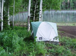
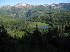
| Trip Report: | Friday, July 9, 2010. I parked at Tibble Fork Reservoir, shouldered my backpack, and walked up the dirt road to the trail that drops down to the American Fork River. At this point the river has three channels separated by gravel bars, the first two of which were easily crossed stepping from rock to rock. The third channel was running fast and deep and was over its bank on the south shore. I scouted up the gravel bar until I found a ford that was only knee deep. After unzipping the lower legs of my pants and trading my hiking boots for river sandals, I waded through the swift current, a little unsteady with the extra weight of the backpack. Four days later I found out that the Forest Service just recently completed a footbridge across the river just upstream. Oh well, as the afternoon was quite warm, the dip in the river was refreshing. The first leg of any backpacking trip is the hardest as your body adjusts to the additional weight of the pack. Lower Mill Canyon has a few steep spots, but for the most part is an easy hike for the first mile or so, it just seemed a lot harder than usual because of the pack and the slower hiking pace it necessitated. When I turned up the Holman Ridge-Cabin Flat Trail, I really shifted into compound low gear. The 2200’ climb to the top of the divide seemed agonizingly steep and I must have dropped down to less than one mile per hour because it took a very long time to get to the top. I did stop to take a lot of pictures, but I also had to stop to catch my breath a lot. After I passed over the divide, I could see Forest Lake below me. In the trees near the top of the divide (elevation 9600’) there was still snow on the north slopes. I hurried down the trail and turned onto the Forest Lake Trail for the 0.6 mi hike (and 600’ drop) down to the campground at the lake. It was after sunset, but still light when I arrived and I had just enough time to pitch my tent, eat my dinner, and secure my food in the trees back of my campsite before dark. Five minutes after I sacked out in the tent the first roll of thunder came up the canyon. A few short minutes later a blinding flash of lightning announced the arrival of the thunderstorm. For almost an hour the frequent flashes of bright lightning and almost deafening roar of the thunder kept me awake. The rain lasted for an hour or two after that. Saturday, July 10, 2010. In the morning I scouted around the lake and discovered that the intake stream is dry already and the same went for the outflow stream. The lake itself was five or six feet low, and the water was pretty swampy looking. I decided not to replenish my water from the lake and instead take my chances that at least one of the four streams I would have to cross today would have water in them. Bad decision. To conserve water, I didn’t use any in cooking this morning – just ate granola bars for breakfast. When I hit the trail back up to the Great Western Trail, I was about an hour and a half later than I had expected to be leaving. The previous night’s rain had not turned the trail into a quagmire, but actually it had done it some good by settling the powdery dust of the previous day and providing somewhat better footing. The brush that crowded the trail closely was soaking wet, of course, and that meant my lower legs got pretty damp. My feet stayed dry however, and that was the important part. When I rounded the northeast slope of Mill Canyon Peak and went through Sandy Baker Pass, it felt good to get out into the sun and find all of the brush dried off. Naturally, there was also a significant temperature difference, so I stripped out of my fleece, and got down to a t-shirt. The next 3 miles offered exceptional views all the way to the Uinta Mountains to the east and the populated valleys far below. The trail itself was puzzling. For no apparent reason it kept dropping down after climbing up to go around ridges. It did this four times and got pretty tiring. I have since learned that the Forest Service is considering fixing this trail by realigning it and keeping it fairly level. With all of the needless climbing, it got uncomfortably hot, and to my dismay, all four of the streams were dry. This left me critically short of water on a hot sunny day. By time I got to the bottom of the last uphill climb, a 900’ straight shot up the mountain, I had only 250ml of spit warm water left. Dry as I was, the last climb was torturously slow. After passing over the divide and back down into the Mill Canyon side, I stopped at Rock Spring along the Great Western Trail. Here the Forest Service keeps troughs for watering backcountry horses. All but one of the troughs were broken up and lying on the ground -- a bad sign. The one remaining trough had only a little slimy snowmelt water in it. I followed the pipe from that trough up to the spring and was relieved to find that the spring was still flowing albeit very slowly. I gulped down a liter of water and then filled another liter for the last 5 miles. Having rehydrated, I felt invigorated, so I was able to pick up the pace – that and the fact that it was all downhill from there to the trailhead. I stopped once at a crossing of upper Mill Creek to refill one of the water bottles – what an awesome device is my HikerPro filter. The never ending switchbacks in upper Mill Canyon saved my knees from a pounding on the steep Holman Trail, the alternate way down, but the pace was so fast that I could feel the blisters rising. Nevertheless, I was compelled to keep the foot-ruining pace up because my family had been expecting me home hours earlier, and I knew that they would shortly be calling out Search and Rescue. At the American Fork River, I did not bother to change into my river sandals, I just plunged across the river in my hiking boots. It had taken me an appalling 9.5 hours to hike 13 miles. |


There are no comments yet.