Oakridge Trail, Congaree National Park - February 25, 2010 - Member Trip Report
| Hike Name: | Oakridge Trail, Congaree National Park |
|---|---|
| Country: | United States |
| State: | South Carolina |
| Trip Rating: |  |
| Trip Date: | February 25, 2010 |
| Duration: | 4 hours |
| Trail Conditions: | Good |
| Trail Traffic: | None |
| Trip Weather: | Sunny, Partly Sunny |
| Trip Winds: | Heavy |
| Trip Precipitation: | None |
| Trip Temperature: | High: 41-50, Low: 41-50 degrees Fahrenheit |
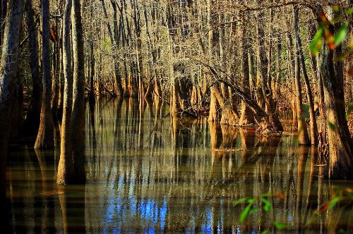
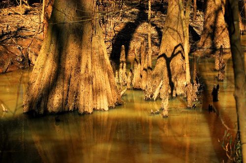
| Trip Report: | The Oakridge Trail is 6.6 miles, but it felt longer than that. Perhaps that was because I took my time on the hike, stopping often to observe big trees. Once off the low boardwalk, and continuing to the far side of Cedar Creek, the trail enters a vast bottomland oak flat. This sector of Congaree is considerably dryer than the Weston Lake area to the north, and the Congaree riverbank to the south. A little bit easier walking on slightly higher ground. I recommend this hike if you want to see big trees. There are many right on the trail. Passing over bridge G, you will find yourself in one of the most primeval areas of Congaree. This is an awesome area and would be a great place to camp on an overnight hike, in fact, one of the reason I did this hike today was to scout such a camp spot. Yeah, I found it! Can't wait to get in there with my little tent, and my camera of course. After the trek through the bottomland oak flats, you will head towards Weston Lake. From there you can take the elevated boardwalk back to the Harry Hampton Visitor Center. Great hike, and another great day at Congaree National Park. |

 Trail Map For This Area
There are no comments yet.