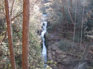
Estatoe - February 20, 2010 - Member Trip Report
| Hike Name: | Estatoe |
|---|---|
| Country: | United States |
| State: | South Carolina |
| Trip Rating: |  |
| Trip Date: | February 20, 2010 |
| Duration: | 3 hours |
| Trail Conditions: | Excellent |
| Trail Traffic: | None |
| Trip Weather: | Sunny |
| Trip Winds: | None |
| Trip Precipitation: | None |
| Trip Temperature: | High: 41-50, Low: 31-40 degrees Fahrenheit |
| Trip Report: | Expanded directions to the trailhead: From Pickens, drive north on US 178 approx 7.5 mils to the bridge over Eastatoe Creek (approximately one mile past the community of Rocky Bottom). Cross the bridge and turn left at the Laurel Valley Lodge sign. Bear right onto the unpaved fork (The road sign reads Horsepasture Road, but the sign is frequently knocked down.) and continue 0.3 miles to the Foothills Trail parking area on the left. From the trailhead, continue on Horsepasture Rd for about 0.1 mile and turn left (south) onto an old logging road marked by a cable gate. This was a fun hike through some nice terrain. The trail is mainly a forest service road until the last half mile when it heads down into the gorge. At the end of the switchbacks leading to the primitive camping area, look to the right for a new trail. Follow it for about 0.2 miles to a newly constructed overlook for observing the falls/sluice. |


 Trail Map For This Area
There are no comments yet.