Three Rivers Canyon - White Mountain Wilderness - April 3, 2003 - Member Trip Report
| Hike Name: | Three Rivers Canyon - White Mountain Wilderness |
|---|---|
| Country: | United States |
| State: | New Mexico |
| Trip Rating: |  |
| Trip Date: | April 3, 2003 |
| Duration: | 3 days, 4 hours |
| Trail Conditions: | Fair to Good |
| Trail Traffic: | None |
| Trip Weather: | Sunny |
| Trip Winds: | Heavy |
| Trip Precipitation: | None |
| Trip Temperature: | High: 51-60, Low: 11-20 degrees Fahrenheit |
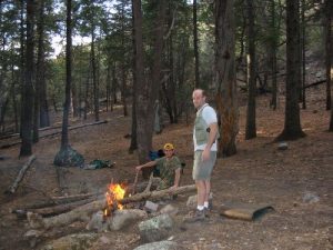
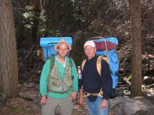
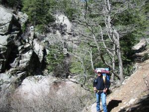
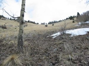
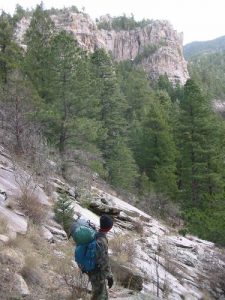
| Trip Report: | We arrived at Three Rivers Campground on Thursday night, around 9:00. After some steaks and many beers, we camped at a permanent campsite near the bathrooms, and crashed. Friday morning - Following a hearty breakfast, we headed out onto the trail around 9:45 in the morning. Mike in the lead, Tom in the middle and me running tail. Tom (age 50) hadn't been on a backpacking trip since he was stationed in Germany 10 years before, so we tried to keep him between us so we could help him out and keep an eye on him. The first 4 miles were fairly smooth, and we decided to stop at a series of pools to try our hand at fishing for Cutthroat trout. Several hours of fishing resulted in two fish that would have been very comfortable in a small aquarium, and one fisherman well soaked from a fall into the stream. By this time it was after 4:00, the sun was starting to go down, and it was getting cold. especially for our wet hiker. We built a fire and set up camp under a rock overhang, and made dinner. Several cups of coffee fortified with Bailey's Irish Cream followed, and after a few hands of poker aroudn the fire, we called it a night around 9:30. Saturday morning - For the record, I dont' care what you do to Alpine Aire pancake mix, you cannot make it edible. Feel free to cook it as long as you like, it will never firm up or turn into anything that even resembles food. I have tried it since at home under perfect conditions, but no dice. Even my Malamute won't eat it, and she'll eat pine cones. After an hour of failed effort, we all gave up and had a quick breakfast of beef jerky and coffee, and hit the trail around 9:15. The second days hike took us to the very origin of Three Rivers, and we had lunch where the creek actually springs up from the ground. The map is slightly misleading here, and the best bet is to stay in the southern fork of the canyon, negotiating a small rockslide at first. The trail starts to get really steep above the rockslide, and you also enter the domain of a largish male Mountain Lion. Elk and deer kill sites are scattered for half a mile on both sides fo the trail. Nothing to worry about, since the lion isn't going to attack three healthy adult hikers, but it does give you something to think about while you walk. The bottom of the Three Rivers Bowl starts just east of the kill sites, and from that point you have to make a decision. The bowl is a full mile climb, and as you can see from the pictures, it is STEEP, something on the order of 50 degree slope. In addition, there is absolutely no flat ground at the top of the Bowl, and it is over a mile to water. We chose to stay at the bottom, intending to make the climb and finish our loop on the last day of the trip. The elevation of the bowl is around 8,300 feet, and the snow was fairly thick in most spots. We dug in our tents, and sat down by a roaring fire for more Bailey's and poker. Called it a night around 10:00. Sunday morning - Got up early since we had a full ten miles of tough walking to cover on the last day. Made a quick run down to the Three Rivers headwaters to fill canteens and Camelbacks, then set out up the Bowl. It is too steep to stand straight up and try to walk, so it becomes a sort of uphill crawl. The mile climb up the Bowl took us until 11:00, and we stopped for a good rest at the top. Temperature was 35 degrees at 11:15, and the wind were in excess of 25 mph, so everybody broke out their wind gear. At this point, I discovered that my Camelback lid wasn't tight, and it had soaked both my thermal top and my windbreaker, leaving me with nothing but my old Army BDU's. Not a good scene. We knew we were going to be pushing to get out by dark, so we set out down the Crest Trail at a rapid pace, and kept it up as we headed down the Dry Canyon Trail. However, we immediately ran into heavy snow, and our pace slowed to a crawl. We found a clear spot for lunch, and scarfed everything we coudl get down, to avoid carrying it. After lunch we headed down Dry Canyon, which is very steep and covered with downed trees from a fire some years ago. As if we needed any help, it began to snow just as we got to the really steep part, and several nasty falls resulted, bringing about the destruction of my original Magellan GPS. RIP. As we went further down Dry Canyon, the snow let off, and we were able to pick the trail up again. The last several miles went smoothly, and we actually got to the car with a little daylight to spare. We used the last of the daylight to have a couple of beers (kept cool in the car by the early spring weather) and headed out, reaching Alamogordo about 7:45. All in all, an excellent trip, but one that I won't do again in the early Spring. |


There are no comments yet.