Beaverhead National Forest - Anaconda-Pintler Wilderness - July 5, 1977 - Member Trip Report
| Hike Name: | Beaverhead National Forest - Anaconda-Pintler Wilderness |
|---|---|
| Country: | United States |
| State: | Montana |
| Trip Rating: |  |
| Trip Date: | July 5, 1977 |
| Duration: | 5 days |
| Trail Conditions: | Fair to Good |
| Trail Traffic: | None |
| Trip Weather: | Partly Cloudy, Cloudy |
| Trip Winds: | Moderate |
| Trip Precipitation: | None, Rain, Showers, Thunderstorms, Snow, Hail |
| Trip Temperature: | High: 61-70, Low: 21-30 degrees Fahrenheit |
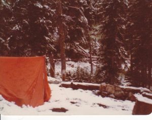
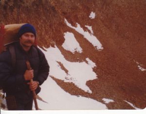
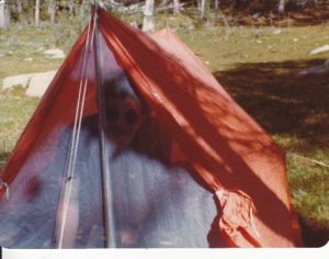
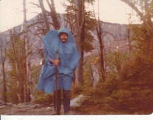
| Trip Report: | 7/5/1977 -- Sandy and I drove from Missoula to Philipsburg this morning, and then easily found our way to East Fork Reservoir. We parked in the trees at the end of the road by the trailhead (Trail #38) and were pleased to note that there were no other vehicles at the trailhead. The trail was a gentle uphill for a couple of miles through a dense lodgepole pine forest, and then as we approached the head of the canyon, we encountered a much steeper segment of the trail. Where our trail intersected with Trail #9 (now the Continental Divide National Scenic Trail) 2.5 miles farther, there was a nice creek and a campsite. We had started the day at 3300’ in Missoula, East Fork Reservoir is at 6100’ and our campsite is at 7800’ so we had determined to go only this far today in order to acclimate to the higher altitude. It was cool and cloudy and threatening to rain when we reached our campsite early in the afternoon, so we got our tent up and our gear stowed before we spent the afternoon exploring the area. After we cooked dinner, we sat around the fire and played cribbage until the rain started after dark. Total for day 4.5 miles. 7/6/1977 -- We had carefully trenched around the tent in anticipation of the rain and consequently, we suffered no leaks although the rain was steady for much of the night. Around 2AM, I awoke and heard instead of the sound of rain on the tent, the quiet hissing sound of snow. I stayed awake for the next couple of hours, periodically slapping the walls of the tent to shake the snow off. I was unable to wake Sandy so that he could take a turn keeping the tent free of snow, and eventually I fell back to sleep. I was next awakened when the roof of the tent suddenly landed on my nose. The weight of the snow accumulating on the tent had caused it to pull up a stake and collapse. Sandy didn’t even wake up then. He did not believe me when I related all this to him when he woke up on his own until he looked out of the tent and saw that we had 3” of snow all around our camp. We had to wait until afternoon before the trail had cleared of snow and we could start our hike for the day. It was 3 miles and 1230’ up to Cutaway Pass where we turned onto trail #111, known as the Hi-Line Trail. That trail followed the ridgeline (which happens to be the Continental Divide) up another 400’ up the slope of Marche Mountain, and then cut straight across the talus on the south slope of the mountain. On the western slope of Marche Mountain, the trail popped back over to the north slope of the divide for a short stretch, but that stretch was still covered with snow – too deep to walk over and too steep to go around. We used our rope to scramble down the slope and up the other side, and hauled our packs across with the rope. After hiking the ridgetop for 2.5 miles, we descended 1900’ feet over 1.5 miles into Maloney Basin and back into the trees. We turned right on trail #24 and followed it down another 600’ feet over 2 miles and set up camp alongside Carpp Creek. Total for the day 9 miles. 7/7/1977 – This morning we turned onto trail #110 and immediately began the 800’ ascent to Carpp Lake, 1.75 miles away. Just past Lower Carpp Lake, we rejoined the Hi-Line Trail and followed it around the ridge west of Carpp Lake. On the other side of the ridge, the trail dropped down a few hundred feet as it crossed another basin, and then started up Porter Ridge. The top of Porter Ridge is at 8200’ and was the high point for this day. Across the ridge, the trail began a steady descent for nearly 4 miles, dropping down to Johnson Lake at 7600’ elevation. Along the way the trail crossed a huge slide area for about half a mile of boulder hopping. We set up camp on the south shore of Johnson Lake and had an afternoon for fishing and exploring. There were several other backpacking parties here -- the first people we have seen on this trek. Total for the day 7.5 miles. 7/8/1977 – This morning we followed trail #96 (now the CDT) from Johnson Lake for 1.5 miles as it ascended across the south slope of Mt. McGlaughlin 1400’ to Rainbow Pass, passing a beautiful alpine lake called Martin Lake on the way up. From the pass we had an expansive view and it was the best so far on this trek. On the far side of Rainbow Pass, we descended 800’ through a series of switchbacks on the talus to Rainbow Lake. From there we descended another 800’ over 3 miles down into Fishtrap Canyon. The timber is very thick in Fishtrap Canyon and the trail follows the creek closely as it goes east, crossing the creek 6 times. Of course, there are no bridges, so each crossing was really rock hopping, with the inevitable slip or two. The water level was high in the creek, the trail was muddy, and the canyon itself was very damp and plagued with insects. We turned north on trail #9 were glad to climb out of this canyon. The pass is 1100’ above the creek and goes through a lot of switchbacks to get there. On the north side of the pass, we dropped down a mere 100 feet to Warren Lake. This lake was the most spectacular campsite of this trek with Warren Peak towering over the lake. Unfortunately, our insect repellant proved ineffective against the clouds of mosquitoes that plagued us here. We were soon driven into the tent. Total for the day 7.25 miles. 7/9/1977 – Sandy chased a porcupine up a tamarack tree this morning and he’s lucky not to have a face full of quills for the effort. We hit the trail in mid-morning, later than usual, and found that only a half mile from our campsite the trail practically fell off the edge of the cirque. We dropped down through a lot of tight switchbacks – enough to almost feel dizzy from all the turning, losing about 1100’ elevation, into LaMarche Canyon. The trail in this canyon stays above the creek, so we did not have the dampness and bugs of the day before. We crossed LaMarche Creek and there the trail ascended the east slope of Beaverhead Mountain and worked itself around to the south slope of Marche Mountain, before beginning a set of broad switchbacks 1730’ up to Cutaway Pass. For much of the climb, we were in dense timber, but as we approached the timberline near the pass, for the first time on this climb we could get a good view of the mountains around us. What we saw was an inky black sky and flashing lightning coming our way. We donned our raingear and sat down in the trees to wait out the storm, rather than get caught in the exposed pass. The thunderstorm was awesome – wind roaring, hail and rain flying horizontally, lightning flashing rapidly, and an almost continuous roar of thunder. When the bulk of the storm passed and settled down to a steady rain, we resumed our hike. Now it was cold, maybe 20 degrees colder than before the storm hit. We hiked the remaining 3 miles to the same camp where we had the snow several days earlier. Total for the day 7.5 miles. 7/10/1977 – We slept in this morning as there was no rush to get anywhere. With the rain last night, it was wet and cold at our camp. Why not stay warm and dry in our sleeping bags? After breakfast, we broke camp for the last time, and casually hiked the 4.5 miles, all downhill, to the trailhead. Great trip. |


There are no comments yet.