Yosemite National Park - Hoover Wilderness - August 7, 1976 - Member Trip Report
| Hike Name: | Yosemite National Park - Hoover Wilderness |
|---|---|
| Country: | United States |
| State: | California |
| Trip Rating: |  |
| Trip Date: | August 7, 1976 |
| Duration: | 6 days |
| Trail Conditions: | Good |
| Trail Traffic: | Moderate |
| Trip Weather: | Sunny, Partly Cloudy |
| Trip Winds: | Light to Moderate |
| Trip Precipitation: | None, Thunderstorms |
| Trip Temperature: | High: 71-80, Low: 31-40 degrees Fahrenheit |
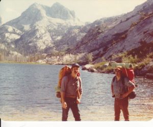
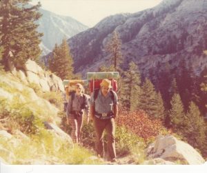
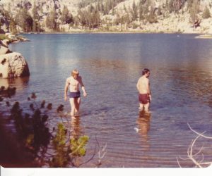
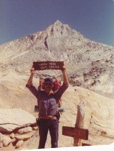
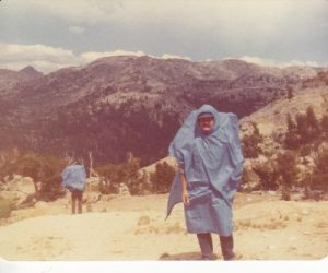
| Trip Report: | 8/7/1976 -- Dave, Ted, and I left Santa Rosa before dawn for the 250 mile drive to Bridgeport. Santa Rosa is only about 100' above sea level and Bridgeport, in the Sierra Nevada Mountains is almost 7000' elevation. We had considered spending the night at Mono Village to acclimate to the higher altitude, but nixed that on the grounds that anybody could handle a 4-mile hike with only a 1300' elevational gain. We should have reconsidered that decision. We arrived at the trailhead west of Mono Village by noon, and ate our lunch in the campground at the trailhead. Backpacks always are heaviest at the start of the trip -- when the load is full and the shoulders not yet conditioned for the load. All of us were already a little bit woozy from the altitude change, and the load made us wonder about our ability to complete this trek. The four miles to Barney Lake passed through some timber but then it came out into the open sage brush, and although it was not really hot, we began to suffer from the combination of load, altitude, and direct sunlight. That four miles took us over four hours. Three weary dudes happily sacked out in the trees at the lower end of Barney Lake that night. Day total 4 miles. 8/8/1976 -- At dawn we arose, cooked up some breakfast, and hit the trail for Peeler Lake. The sleep had done us wonders -- not only rejuvenating us from the effort of the previous day, but more importantly, while we slept, our bodies acclimated to the high altitude. We hiked the 3 miles (with an 1100' climb) in about 2 hours, feeling alive and full of energy. Peeler Lake was fairly small but of unparalleled beauty. Sierra granite ringed this lovely place. We hiked around the north shore of the lake and entered Yosemite National Park on the far side, while descending into Kerrick Meadow. The hike down Kerrick Meadow was a gentle stroll for 5.5 miles, only descending 300'. This meadow was beautiful beyond description -- a high alpine meadow bordered by magnificent granite domes and peaks in every direction. We stopped for the day at Arndt Lake, on the east side of the canyon, at about noon. After lunch and relaxation, we took a swim in the icy waters of the lake. Our group was the only one at Arndt Lake this day, although we had encountered one group of backpackers going in the opposite direction in Kerrick Meadow. Day total 8.5 miles. 8/9/1976 -- The 3-mile hike (with 400' climb) up to the top of Seavey Pass was easy this morning. The 1200' descent into Benson Lake was our first steep descent of this trek, and as often happens, the downhill pounding raised a few blisters. We spent most of this day hanging around camp at Benson Lake, went for a swim, explored around the lake, nursed our blisters, made a fine freeze-dried meal of beef stroganoff. But the lake was a disappointment for me. The lake itself was fine, not as spectacular as many, but certainly surrounded by handsome peaks, but the campground at the upper end of the lake was the biggest backcountry campground I have ever seen. And it was darn near full of backpackers. The Village of Benson Lake -- enough noise to satisfy any big city dweller -- almost. We were going to spend a whole day here tomorrow and another night, but both Ted and Dave agreed that this sizable community detracted from our wilderness experience, so we are pulling up stakes in the AM. Day total 5 miles. 8/10/1976 -- Another problem with Benson Lake is that it sits in a deep hole. Any way out is up, up, up. We began climbing as soon as we forded Piute Creek just above the campground, and for the next 7.5 miles that's all we did -- 2200' climb. We paused for lunch at Smedberg Lake, 5 miles from Benson, and tried our hand at fishing -- didn't catch anything. Too bad, because a little fresh fish would have been welcome after all the freeze-dried meals. Smedberg Lake is right at the tree line, so it was sunny and shady -- take your pick. A beautiful place to relax for a couple of hours. Pushing on in the afternoon, we had 2.5 miles and 700' more climbing to get to the top of Benson Pass. As soon as we attained the top of the pass at 10200' elevation, we were greeted with dark clouds to the north and we could hear the thunder rolling down the canyon below us. So we broke out our ponchos, and scurried the last mile for the day, descending 1200', to make sure we weren't on the pass when the thunderstorm got to us. The rain started right after we selected a nice place along Wilson Creek, with lots of trees and easy access to the creek, and set up our camp. So far on this trek we have been sleeping under the stars, but this night called for the tube tents. By time we got set up the rain was pelting down. We cooked our dinner on the backpacker's stove we had brought for just such an occasion, and retired to our luxurious tube tents. Day total 9.5 miles. 8/11/1976 -- The rain had stopped by morning, but we were pretty damp (tube tents being a less than ideal shelter -- they drip condensation on you all night). Our campsite was going to be hours from getting any warming rays of the sun, as it was in a narrow canyon with a granite wall towering more than 1000' above us to the east. We ate our breakfast, and packed up all of our damp things to go find some sun. The dampness made us pretty cold. We hiked about a mile before we turned into Matterhorn Canyon, but along the way we passed three other backpacker groups huddling in the cold and damp. At this point Matterhorn Canyon was heavily timbered, and we still weren't getting any warm sunlight. A mile up the canyon, the Pacific Crest Trail turned to the right to climb up out of Matterhorn Canyon and on to points south. We stayed on the trail going all the way up Matterhorn Canyon, climbing all the way -- 8.5 miles with a 2100' elevational change. About half way up the canyon, the canyon narrowed considerably and the timber thinned out. We found a place to make lunch that was nice and sunny. Stringing our cords between trees, we hung out our sleeping bags, tube tents, and damp clothes to dry while we sunned on some rocks for an hour or two. Then we slowly ascended the rocky Burro Pass, the highest point on this trail at 10656'. On the other side we almost felt giddy to skip the last 2 miles to our campsite as it was downhill for 2 miles (1000' descent). Our camp here was the best, so far. We had not seen another party since the damp morning, and here we had a beautiful creekside camp to ourselves. After dinner, two does and a buck wandered past our camp. As the sun set, it lit Matterhorn Peak (a 12264' mountain) at the east end of the canyon with beautiful alpenglow. Life is good, Yosemite is gorgeous. Day total 11.5 miles. 8/12/1976 -- This morning we broke camp and hiked 2 miles down the canyon and up the wall of rock on the west side. We climbed 1000' in 2 miles, and did it so easily we about forgot that the pass, our last on this trek, was only 50' lower than Burro Pass. Passing through a notch on the north slope of Slide Mountain, we re-entered Hoover Wilderness and came into the lovely Crown Point Basin. The north slopes here still had significant snow fields on them, right down to the trail. The trail descended 2200' over 4.5 miles, going past several alpine ponds of extraordinary clarity, as well as lovely Crown Lake, and finally arrived back at Barney Lake. We set up camp at Barney Lake and sat up well into the night enjoying our last night in the wilderness, and sharing our favorite parts of the trek. Day total 6.5 miles. 8/13/1976 -- It was noon when we reached our car at the trailhead in Mono village campground. After beer and pizza for lunch in Bridgeport, we drove home to Santa Rosa. Day total 4 miles. |


There are no comments yet.