Yosemite National Park - Hetch Hetchy - June 20, 1970 - Member Trip Report
| Hike Name: | Yosemite National Park - Hetch Hetchy |
|---|---|
| Country: | United States |
| State: | California |
| Trip Rating: |  |
| Trip Date: | June 20, 1970 |
| Duration: | 5 days |
| Trail Conditions: | Fair |
| Trail Traffic: | None |
| Trip Weather: | Sunny |
| Trip Winds: | Light |
| Trip Precipitation: | None |
| Trip Temperature: | High: 81-90, Low: 41-50 degrees Fahrenheit |
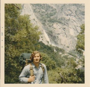
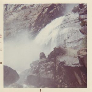
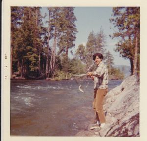
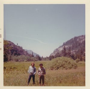
| Trip Report: | The website wouldn't recognize a date in the 1960s under the "Trip Date" (I know it is ancient history -- but they really happened and some of us were actually hiking and backpacking back then), so I had to put in a date that was actually a year later. In my many years of backpacking, this trip always stands out: it was the first I ever did independent of my father, and it was done before backpacking skyrocketed in popularity. Because this trip was done in the years before backpacking became the rage, we met only one other party on our entire hike (yes, this is IN Yosemite National Park). The tradeoff, however, for pre-dating backpacking’s impending popularity was that there were very few choices in the way of equipment, and very little of that was anywhere near as sophisticated or technologically advanced as today’s equipment. Our backpacks were wooden-framed canvas Boy Scout models, and we were grateful for the frames (a fairly new concept back then), even though nobody had dreamed up the hip belt, yet. Our sleeping bags were big, heavy, cotton kapok-filled monsters. Freeze-dried meals were yet in the future, so we carried canned food. Our boots were heavy leather uppers with a crepe sole (vibram soles were not yet available). Very little was available in synthetic fabrics, so our clothes were denim and wool topped with Army flak-jackets for warmth. All of this meant that the packs got heavy with relatively little in them. Carrying only the bare minimum of supplies (we even eliminated a tent – no ultralites back then), the 30 pounds was a backbreaking load in those old-fashioned packs. 6/19/1969 (Thu) -- Joe and I loaded up the VW bus after work, and drove from Orange County to near Yosemite during the night. It was 2AM when we pulled over to sleep somewhere between Coarsegold and the South Entrance, and after gazing in awe at the magnificent star show, we sacked out in the van until daybreak. 6/20/1969 (Fri) -- After getting a bite to eat, we drove into Yosemite National Park and drove around the Mariposa Grove of Giant Sequoias. Sadly, the amazing Wawona Tunnel Tree fell a few months ago under a staggering load of snow. My father used to say that he had had his photo taken with every car he ever owned in the tunnel through that tree. From there we drove into the Valley and spent several hours hiking up to the base of Bridal Veil Falls, Mirror Lake, Vernal Falls, and the base of Yosemite Falls, as well as driving all of the roads of the valley with numerous stops. Finally, we drove out the Big Oak Flat Road through the Tuolumne Grove of Giant Sequoias, and on up to O’Shaughnessy Dam at the west end of Hetch Hetchy. We ate our lunch at the trailhead, then shouldered our packs and set out across the dam. This whole day the hiking was hard on us as we had not adjusted to the weight on our backs, and we had hit the trail just as the heat of the day was beginning. When we came to the point where the road and the trail parted ways, we were greeted with a sign telling us that the trail to Rancheria was closed because of dangerously high water at Wapama Falls. We chose to ignore the sign and hike it anyway as the only alternative would be to commence a grueling climb up the face of the mountain and hike another trail. The sign was not exaggerating the conditions at Wapama Falls – the bridge deck was under 6 inches of hard-flowing water (I would find out the following year that it is normally about 8 or 10 feet above the stream). Oh, well, it was a steel bridge, and it looked sturdy enough, so we removed our boots, rolled up our pants legs, and went across. Once we were east of the falls, the trail began a long uphill stretch that sapped our strength badly. Joe had packed a carton of cigarettes for this trip, but part way up this leg of the trail, he stopped and pulled the carton from his backpack and tore up every cigarette in it. He might not have done that if he had known that I (a non-smoker) was having as difficult a time as him. It was getting hot, the packs were heavy and pulling hard at our shoulders, and the grind of the constant uphill was wearing us down. Joe was elated when we began the descent to Tiltill Creek, but I didn’t get excited because I knew that every foot we went down at this point would have to be made up on the other side to get to our campsite. Just as I feared, the climb to Rancheria Falls campsite was a staggering series of switchbacks that nearly finished us off. Both of us were darn near on our hands and knees before we finally reached the campsite. Two weary guys set up camp, cooked a dinner of beans and franks, and laid out to watch the star show. Total for the day 6.0 miles. 6/21/1969 (Sat) – Neither of us wanted to hit the trail today after the previous day’s ordeal. So we stayed for the whole day at Rancheria Falls, hiked around sans packs, and did some fishing. Joe caught several rainbow trout which became our dinner. He paid for those trout, however, by falling in the ice-cold waters of the creek. We had to hang his clothes up near the fire for much of the afternoon to get them dried out. 6/22/1969 (Sun) – This morning we both felt fully rejuvenated so we packed up to move to another location. The trail up to the pass above Rancheria Falls was exposed to the sun much of the way, but it felt good in the morning after a chilly night. We were both delighted when the 1300’ climb into the pass presented no challenge to either of us. The pass itself was very mucky and full of mosquitoes. We dashed through and descended the 400’ into Tiltill Valley. We had to cross a meadow to get to the campsite at the far side of the valley, and the meadow in this wet year, was a swamp. The trail was visible, alright, but it was under standing water all the way across the meadow and was bordered by grass that was at least 5 feet high. Once again we removed our boots and rolled up our pants, sinking to our knees in the muck in the meadow. When we set up camp at the end of the meadow, we decided to call it a day, get cleaned up, and do some fishing. Here, however, the fish weren’t biting. Once again, we explored all around sans packs. Toward sunset, we met an Australian guy and his son, as they descended the Tiltill Mountain trail and set up camp near us. They told us that they had suffered terribly from the mosquitoes up the trail. Total for the day 3 miles. 6/23/1969 (Mon) – Due to the Aussie’s report, we scratched our plans to go up Tiltill Mountain on this trip and instead turned our attentions to Lake Vernon. Joe wanted to fish more in Tiltill, so while he did that, I hiked the trail up the shoulder of Mt. Gibson, climbing 2100’ over 3 miles to scout out the lake. Upon my return to camp, Joe declined any interest in doing a climb like that tomorrow or any day. Consequently, we will have to turn around here. Total for the day 6 miles. 6/24/1969 (Tue) – Hiking back to Hetch Hetchy the way we had come in seemed like defeat to me, but my companion wanted it that way. Today, we slogged our way through the muck in the meadow in Tiltill Valley, made the easy climb into the pass, and descended to Rancheria Falls campsite again. These 3 miles went by quickly, so we had nearly the whole day to kill at Rancheria again. Fishing was good, and we ate more trout for dinner. Total for the day 3 miles. 6/25/1969 (Wed) – The six-mile hike back to the dam was way easier than when we came in, and even Joe was beginning to regret the decision to retrace our steps. But back at the car, he let me know that while he was glad we did this hike together, he was not planning to do it again. Well, for me, it was a wonderful way to celebrate our recent high school graduation, and I, for one, would be back, and often. Total for the day 6 miles. |


There are no comments yet.