Uinta National Forest -- Battle Creek Loop - November 1, 2008 - Member Trip Report
| Hike Name: | Uinta National Forest -- Battle Creek Loop |
|---|---|
| Country: | United States |
| State: | Utah |
| Trip Rating: |  |
| Trip Date: | November 1, 2008 |
| Duration: | 4 hours, 10 minutes |
| Trail Conditions: | Fair |
| Trail Traffic: | Light |
| Trip Weather: | Partly Cloudy |
| Trip Winds: | Light |
| Trip Precipitation: | None |
| Trip Temperature: | High: 31-40, Low: 21-30 degrees Fahrenheit |
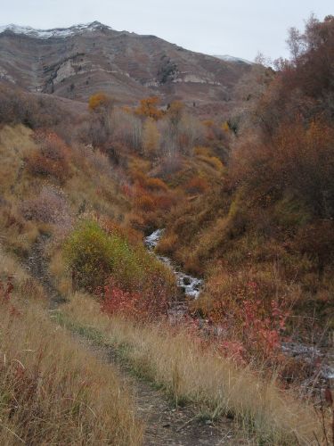
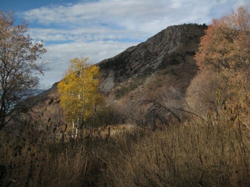
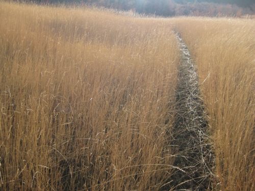
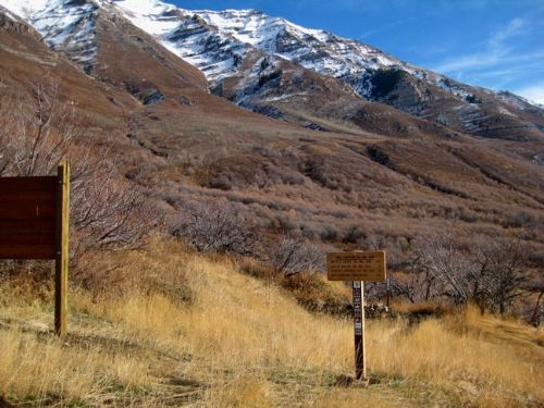
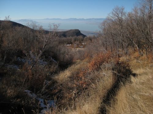
| Trip Report: | I arrived at the Grove Creek Trailhead well before dawn, strapped on my headlamp and started down the Bonneville Shoreline Trail. The 1.25 mile hike along this trail to Battle Creek is just as well done in the dark as the day. The trail has not been developed, yet, and it is really just a series of trails and roads under the power lines. That is unsightly enough, but to make it worse, the road department dumps all the road kill deer along this route, and the slobs of America have also dumped unwanted furniture and things here. Once safely through the dump, there was enough light in the sky to turn off the light on my forehead, and that was just as I turned up the Battle Creek Trail. This trail is steep and always takes my breath away, not so much in the lower reaches as above the waterfall. The waterfall itself was reduced to a mere trickle compared to its spring runoff torrent. It is late in the fall, so most of the fall colors are gone from the trees, leaving a dull brown in the oak trees, and a soggy black mess of aspen and maple leaves on the trail. The grass and brush, however, still has a significant amount of russet and red coloration to it. It took me an hour and a half to make the 2000’ climb (over 2.5 miles) through Battle Creek Canyon and up onto Sagebrush Flats on the bench above the valley. The views from up there are great. Up on the bench, every shady area had snow in it, so it is obvious that hiking here will not continue much more this year. I walked with ease to the point where the trail began to drop down into Grove Creek Canyon, and here I found some difficulty. The snow covered the trail with a wet blanket that added a high degree of instability to every footstep and did a good job of hiding the trail, too. These conditions I found wherever the trail was on a north facing slope, which is to say, for another mile until the trail crossed the creek to the other side of the canyon just above Grove Creek Falls. From the falls on down to the trailhead, the trail was sunny and dry. On this stretch is where I met group after group of hikers going up. It’s a very popular trail, but relatively few people actually attempt the loop hike. Hey, that’s one of the reasons I like this hike. |


There are no comments yet.