Appalachian Trail - Killington Peak To Clarendon Gorge - Member Hike
| Hike Name: | Appalachian Trail - Killington Peak To Clarendon Gorge |
|---|---|
| Country: | United States |
| State: | Vermont |
| Nearby Town: | Killington |
| Rating: |  |
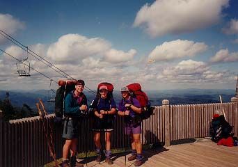
| Directions: | From Boston, MA: Take I-93 north to just south of Concord, NH. Exit onto I-89 north and follow to U.S. Route 4 / Rutland, exit 1 in Vermont. Follow Route 4 west to Killington and signs to the Ski Resort. The Appalachain Trail is accessible via a short hike on a side trail from the top of Killington Peak. Take the chairlift to the summit. Travel mileage is 158 miles and approximately 2.75 hours. |
| Total Hike Distance: | 11.70 miles |
| Hike Difficulty: | Moderate |
| Permit Required: | No |
| Hike Type: | One-Way, Shuttle Hike |
| Hike Starts: | Killington Peak |
| Hike Ends: | Clarendon Gorge |
| Trails Used: | Appalachian Trail |
| Backcountry Campsites: | Yes |
| Backcountry Water Sources: | None |
| Management: | U.S. Forest Service |
| Contact Information: | Green Mountain and Finger Lakes National Forests 231 North Main Street Rutland, VT 05701 (802) 747 - 6700 |
| Best Season: | Fall |
| Users: | Hikers, Dogs |
| Road Conditions: | Primary Paved Roads, Secondary Paved Roads |
| Hike Summary: | The Appalachian Trail climbs from the suspension bridge at Clarendon Gorge over VT 103 and up 3000 feet to Killington Peak. The state was named "Verd-mont" here by a Frenchman in the 1700's, and the summit is off a side trail to the right at 4,235 feet. The views from here are spectacular, and the states of Vermont, New Hampshire, New York, Massachusetts, Maine and even Canada are visible on a clear day. A chair lift runs daily to Killington Peak in the summer. |


There are no comments yet.