A.T. - Stratton Mountain to Bennington (VT 9) - Member Hike
| Hike Name: | A.T. - Stratton Mountain to Bennington (VT 9) |
|---|---|
| Country: | United States |
| State: | Vermont |
| Nearby Town: | Bennington |
| Rating: |  |
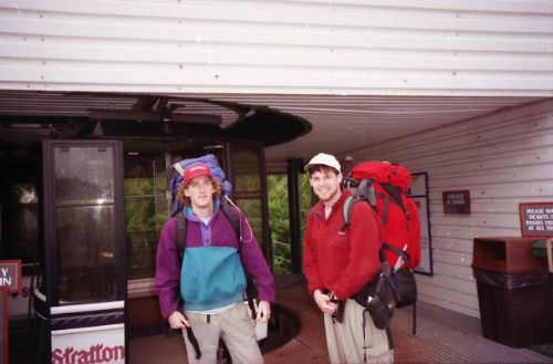
| Directions: | The trail starts at the top of Stratton Mountain which you can access via the gondola. Here are directions to the base of the mountain: From Hartford and New York City Take I-95 North to New Haven, CT (about 80 miles) Take I-91 North to Brattleboro, VT (Exit 2) (about 120 miles) Take Routes 30 North to Bondville (about 38 miles) In Bondville take the Stratton Mountain Road 4 miles to the Resort |
| Total Hike Distance: | 25.70 miles |
| Hike Difficulty: | Moderate |
| Permit Required: | No |
| Hike Type: | One-Way, Shuttle Hike |
| Hike Starts: | Stratton Mountain |
| Hike Ends: | Bennington (VT 9) |
| Trails Used: | Appalachian Trail |
| Backcountry Campsites: | Yes |
| Backcountry Water Sources: | Springs |
| Management: | U.S. Forest Service |
| Contact Information: | Green Mountain and Finger Lakes National Forests 231 North Main Street Rutland, VT 05701 Phone: (802) 747 – 6700 FAX: (802) 747 - 6766 TTY: (802) 747 - 6765 |
| Best Season: | Summer, Fall |
| Users: | Hikers, Dogs |
| Road Conditions: | Primary Paved Roads, Secondary Paved Roads |
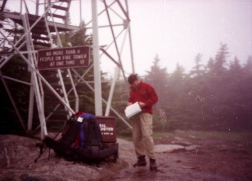
| Hike Summary: | From VT 9 near the town of Bennington, The Appalachian Trail climbs past the Goddard, Caughnawaga, Kid Gore, and Story Spring Shelters and reaches a fire tower at Stratton Mountain. Benton MacKaye, who first published a proposal for the creation of the Appalachian Trail, is thought to have come up with the idea during a hike on this mountain. A cabin with a summer caretaker is near the summit for overnight use, and a side trail leads a short distance to the Stratton Ski Area where a gondola provides access to the base of the mountain. |


Recommended


Trip Reports
| Date | Rating | Duration | Hiker | |
|---|---|---|---|---|
 - July 1, 1996")
|
July 1, 1996 | |
1 day | Mackie |
 - June 30, 1996")
|
June 30, 1996 |  |
1 day | Mackie |
There are no comments yet.