Uinta National Forest - Summit Loop - Member Hike
| Hike Name: | Uinta National Forest - Summit Loop |
|---|---|
| Country: | United States |
| State: | Utah |
| Nearby Town: | Salt Lake City, UT |
| Rating: |  |
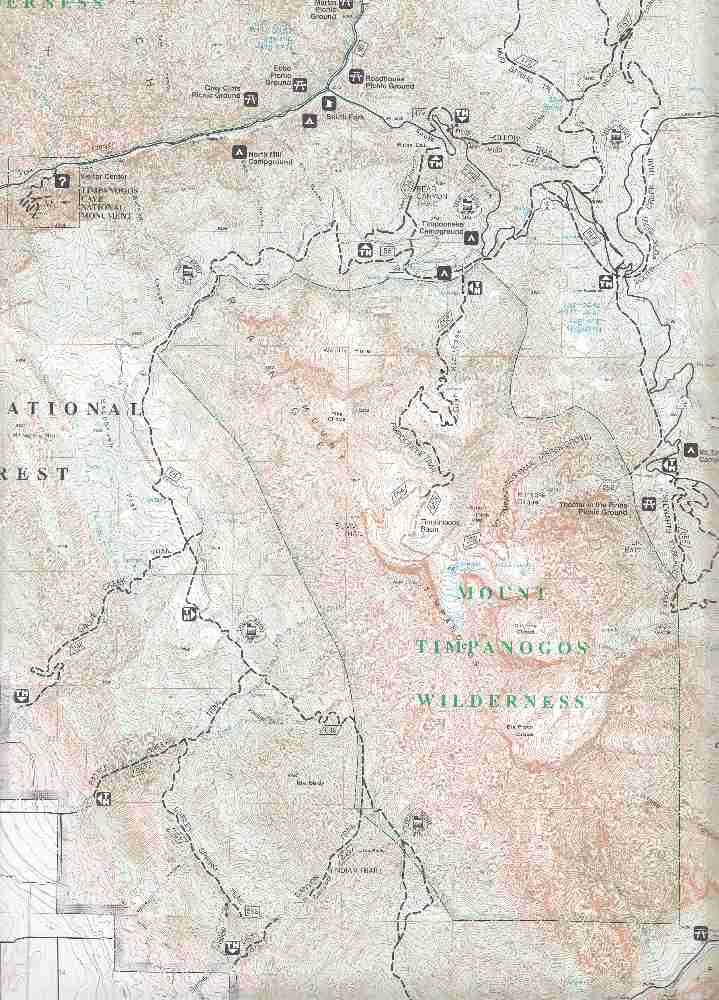
| Directions: | From Salt Lake City go south on I-15 23 miles to exit #284. Go east on SR92 through Timpanogos Cave National Monument (there is a fee station) for 7.7 miles. Right after the first big switchback, you will see the Pine Hollow Trailhead on the right. |
| Total Hike Distance: | 10.50 miles |
| Hike Difficulty: | Moderate |
| Permit Required: | Yes |
| Hike Type: | Roundtrip, Loop Hike |
| Hike Starts/Ends: | Pine Hollow Trailhead |
| Trails Used: | Pine Hollow, Ridge Trail (Great Western Trail), South Fork Deer Creek |
| Backcountry Campsites: | No |
| Backcountry Water Sources: | Streams, Springs, Snow |
| Management: | U.S. Forest Service |
| Contact Information: | Uinta National Forest Pleasant Grove Ranger District 390 North 100 East Pleasant grove, UT 84062 801-342-5247 |
| Best Season: | Winter, Spring, Summer, Fall |
| Users: | Hikers, Bikers, Dogs, Horses |
| Road Conditions: | Primary Paved Roads, Secondary Paved Roads |
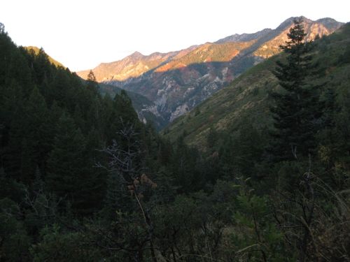
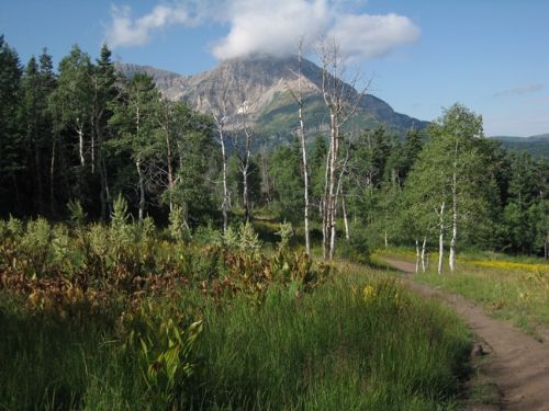
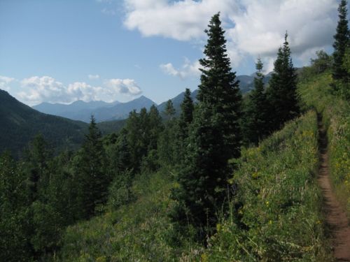
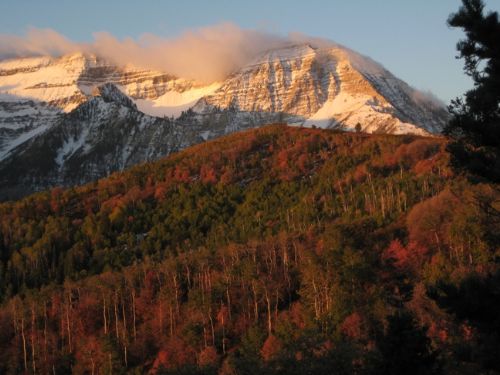
| Hike Summary: | This trail is a beautiful all-season hike, with many variations possible to suit the hiker’s time frame. In June, the variety of wildflowers is delightful. From late September through October, this trail incorporates some of the finest fall colors in the Rocky Mountains, as it passes through vast expanses of quaking aspen (which turn golden yellow) and mountain maple (which turn scarlet). Obviously, due to the elevations, ranging from 6400’ to 8200’, snow blankets the area from November through May. SR92 is closed during the winter, but is open to the Pine Hollow trailhead, which means that this route is an outstanding snowshoe trail in the winter. For a shorter hike (6.75 mi) with less climbing, drive 4.8 mi beyond Pine Hollow Trailhead to the Summit Trailhead and simply eliminate trail #047, Pine Hollow Trail from the itinerary. The trail (#047) starts on the opposite side of SR92 from the parking lot at the Pine Hollow Trailhead, and begins climbing immediately. Mostly in a fir forest, but for a short stretch before it enters the hollow itself, the trail crosses a steep open slope. The elevational gain is 1200’ over the 2-mile length of trail #047. On the way the trail goes through two meadows. The first meadow is where trail #047 intersects trail #150. Stay on trail #047 until it joins trail #157 (also known locally as the Ridge Trail, this trail is a segment of the Great Western Trail). Turn left onto trail #157 and follow it up and around a ridge for 1 mile. This segment of the trail affords spectacular views of Mt. Timpanogos to your left. At the Junction with the Mud Springs Trail (#173) stay to your right on trail #157 as it climbs through a saddle in a lovely grove of quaking aspens and then onto an open ridge for one more mile. At the junction with the Tibble Fork Trail (#041) you will be at 8200’ (1800’ above your starting point) the high point of this loop. At that junction, turn right onto the South Fork Deer Creek Trail and stay on this trail for 3.5 miles. It will drop 800’ into an open valley where it crosses the Cascade Springs Road and then it slowly climbs 660’ back in the timber to the Summit Trailhead. From Summit Trailhead, cross SR92 and pick up trail #157 again, and follow it for 1 mile (you will descend about 600’) until it joins the Pine Hollow Trail (#047) on the north side of the second Pine Hollow meadow. From that junction, it is 2 miles and 1200’ lower down to the trailhead parking lot. |

Recommended


Trip Reports
| Date | Rating | Duration | Hiker | |
|---|---|---|---|---|

|
February 6, 2010 | |
4 hours, 15 minutes | gmyersut |

|
October 17, 2009 |  |
3 hours, 40 minutes | gmyersut |

|
July 11, 2009 |  |
4 hours, 20 minutes | gmyersut |

|
June 2, 2009 | |
3 hours, 30 minutes | gmyersut |
There are no comments yet.