Uinta National Forest - Big Baldy Peak Loop - Member Hike
| Hike Name: | Uinta National Forest - Big Baldy Peak Loop |
|---|---|
| Country: | United States |
| State: | Utah |
| Nearby Town: | Salt Lake City, UT |
| Rating: |  |
| Directions: | From Salt Lake City, go south on I-15 to exit #275, Pleasant Grove Blvd. Turn left onto the boulevard and follow it to the State Street (US89) light. Turn right onto State Street and go 3.1 miles to 200 South in the city of Lindon. Turn left onto 200 South and go 1.7 miles to Dry Canyon Drive. Turn left and watch for a road on the right about 0.25 mile ahead. Turn right onto this road and follow to the trailhead. |
| Total Hike Distance: | 9.10 miles |
| Hike Difficulty: | Difficult |
| Permit Required: | No |
| Hike Type: | Roundtrip, Loop Hike |
| Hike Starts/Ends: | Dry Canyon Trailhead |
| Trails Used: | Dry Canyon Trail, Battle Creek Trail, Curley Springs Trail. |
| Backcountry Campsites: | No |
| Backcountry Water Sources: | Streams, Springs |
| Management: | U.S. Forest Service |
| Contact Information: | US Forest Service Pleasant Grove Ranger District 390 N 100 E Pleasant Grove, UT 84062 801-342-5247 |
| Best Season: | Spring, Summer, Fall |
| Users: | Hikers, Bikers, Horses |
| Road Conditions: | Primary Paved Roads, Secondary Paved Roads |
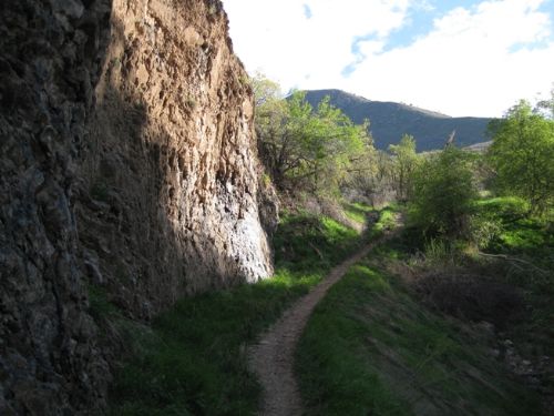
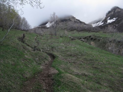
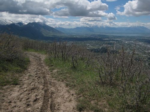
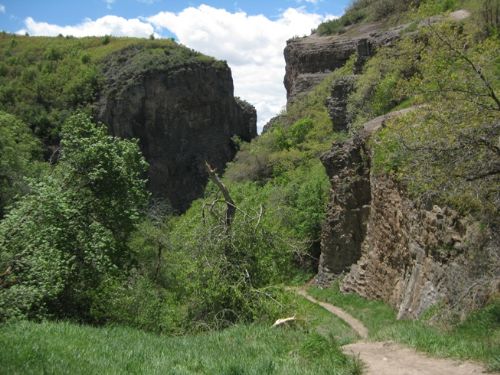
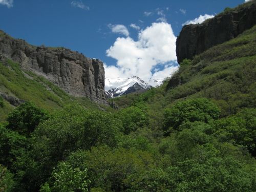
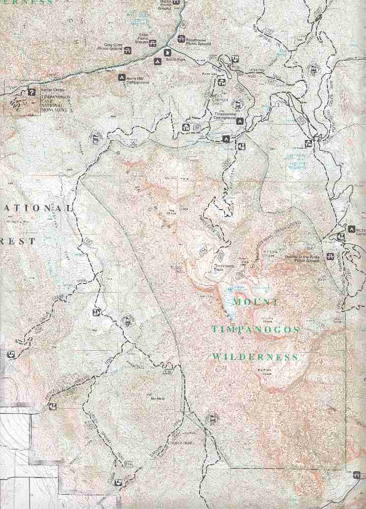
| Hike Summary: | From the trailhead, follow Dry Canyon Trail (#049) up the canyon for 2.5 miles. The trail is very steep, rising 3500’ in that distance. The first 0.5 mile is so steep that it starts out with steps. In that first half mile, the trail will pass between towering cliffs that resemble a medieval fortress gateway. After the junction with the Curley Springs Trail, the grade gets gentler, but it remains a relentless uphill for 2 more miles, first passing through a forest of oak scrub, then a forest of mountain maples, and finally at the top of the canyon, it goes trough a grove of quaking aspens. The oaks and maples give a lot of shade in season, but they also cut off the view of the mountains, so the hiker can not see the goal for the trees. Just as the trail finally climbs into the aspen grove, there will be more open areas and meadows from which the hiker gets a magnificent view of the Wasatch Mountains and Utah Valley far below. From there, the trail passes over the ridge behind Little Baldy Peak at the high point of the trail (8300’ elevation) and descends through more aspens in a series of switchbacks for 1.5 miles, before leveling out in an open meadow for 1 mile. At the junction with Battle Creek Trail (#050), turn left. The next 1.1 miles are a very steep descent through a maple forest. At the junction with the Curley Springs Trail (#051), turn left, cross the creek, and for the next 1.25 miles the trail will ascend about 700’ through a maple forest. Finally, at the top, it opens into an oak scrub area with scant shade but terrific views of Utah Valley. Then the trail descends to the junction with Dry Canyon Trail (#049) 1.25 miles ahead. Turn right onto Dry Canyon Trail and follow for 0.5 mile as it descends steeply to the trailhead. |


There are no comments yet.