Uinta National Forest -- Battle Creek Loop - Member Hike
| Hike Name: | Uinta National Forest -- Battle Creek Loop |
|---|---|
| Country: | United States |
| State: | Utah |
| Nearby Town: | Salt Lake City, UT |
| Rating: |  |
| Directions: | South on I-15 to exit 275 (Pleasant Grove Blvd), turn left onto the blvd. The blvd turns into Center St. At 100 East, turn left. Then turn right onto 500 North. Follow 500 North up the hill to the trailhead at the end of the street. |
| Total Hike Distance: | 8.25 miles |
| Hike Difficulty: | Moderate to Difficult |
| Permit Required: | No |
| Hike Type: | Roundtrip, Loop Hike |
| Hike Starts/Ends: | Grove Creek Trailhead |
| Trails Used: | Bonneville Shoreline Trail, Battle Creek Trail, Great Western Trail, Grove Creek Trail |
| Backcountry Campsites: | No |
| Backcountry Water Sources: | Streams, Springs |
| Management: | U.S. Forest Service |
| Contact Information: | Uinta National Forest Pleasant Grove Ranger District 390 North 100 East Pleasant Grove, UT 84062 801-342-5247 |
| Best Season: | Spring, Summer, Fall |
| Users: | Hikers, Dogs, Horses |
| Road Conditions: | Secondary Paved Roads |
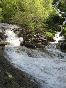
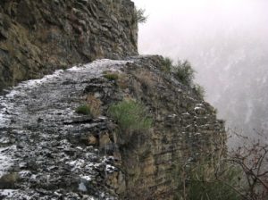
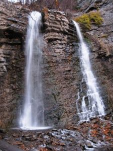
| Hike Summary: | This trail is a good hike in either direction. It may be easier in the opposite direction than the one given here, but I prefer to do it counterclockwise because Battle Creek Canyon has some very steep sections of trail, and I find it easier to ascend steep trails than to descend them. The steep descent can be very slippery in wet conditions. At the Grove Creek Trailhead, follow the trail #048 for about 50 yards and watch for a trail that drops down to the right and crosses Grove Creek in the trees. The opposite bank is steep, but once across, you will see a trail that climbs the slope to the left. This is the as-of-yet undeveloped Bonneville Shoreline Trail. It’s really a bunch of multiple-use trails that more or less parallel the power lines. Choose any path you want -- they all eventually find their way 1.25 miles to Kiwanis Park. Hike through the park and across the footbridge. Once across the bridge, turn immediately to the left onto Battle Creek trail #050. The lower part of this trail is a service road for the irrigation company, but once past the spillway pond about 0.3 mi up, the trail narrows to a footpath. At 0.6 mi a side trail angles off to the right and goes down to the waterfall. Battle Creek Falls are about 50’ high and provide wonderful natural air conditioning in the hot summer months, worth the short side trip. Beyond the waterfall, the trail has several very steep sections, interspersed with more gentle slopes. At 1.90 mi past the waterfall, the trail emerges from Battle Creek Canyon and joins the Great Western Trail (#049). At this point, the trail is in an open meadow at 7400’ elevation (2300’ higher than your starting point). For the next 1.1 mi the trail gains only 400’ as it passes through timber and meadows. At the junction with the Grove Creek Trail (#048) turn left. Follow this trail past a series of springs, cascades, and falls as it descends 2700’ over the next 3.4 mi to the trailhead. |
Recommended
Trip Reports
| Date | Rating | Duration | Hiker | |
|---|---|---|---|---|
|
May 25, 2009 |  |
3 hours, 40 minutes | gmyersut |
|
November 1, 2008 |  |
4 hours, 10 minutes | gmyersut |


There are no comments yet.