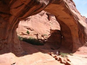
Tower Arch - Arches National PArk - Member Hike
| Hike Name: | Tower Arch - Arches National PArk |
|---|---|
| Country: | United States |
| State: | Utah |
| Nearby Town: | Moab |
| Rating: |  |
| Directions: | Enter the Park at the main entrance and follow the main road to the Salt Valley Rd. on the left. Take that dirt road for about 7.7 miles, continuing straight through a junction to a sign for Tower Arch. Park at the end of the road. |
| Total Hike Distance: | 3.50 miles |
| Hike Difficulty: | Moderate |
| Permit Required: | Yes |
| Hike Type: | In & Out, Backtrack Hike |
| Hike Starts/Ends: | Klondike Bluffs parking area |
| Trails Used: | Tower Arch Trail |
| Backcountry Campsites: | No |
| Backcountry Water Sources: | None |
| Management: | National Park Service |
| Contact Information: | By Mail Arches National Park PO Box 907 Moab, UT 84532-0907 By Phone Visitor Information (435)719-2299 Visitor Information (TDD) (435)719-2319 Headquarters (435)719-2100 Website = http://www.nps.gov/arch/index.htm |
| Best Season: | Winter, Spring, Summer, Fall |
| Users: | Hikers |
| Road Conditions: | Primary Paved Roads, Secondary Paved Roads, Maintained Gravel or Dirt Roads |
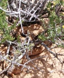
| Hike Summary: | The trail climbs a steep, but short, rock wall, cuts across a valley and then meanders through sandstone fins and sand dunes. An alternate, shorter trail (0.3 mile [0.4 km] one way), begins at the end of the four-wheel-drive road on the west side of Tower Arch, left at the junction mentioned in directions. This unpaved road washes out quickly in rainstorms; inquire at the visitor center about road conditions before heading out. Trail is probably the least crowded one in the park due to its remoteness but a real jewel. The arch is a great place for lunch. Anne actually startled a rattlesnake in the middle of the trail on the way to the arch (or it startled her). Fortunately she heard the rattle and we were able to wait until the snake moved under a bush (see picture). When we returned by the same trail, the snake was all gone. |


There are no comments yet.