Syncline Loop – Canyonlands NP - Member Hike
| Hike Name: | Syncline Loop – Canyonlands NP |
|---|---|
| Country: | United States |
| State: | Utah |
| Nearby Town: | Moab |
| Rating: |  |
| Directions: | – From Moab to the Island in the Sky visitor center is 32 miles. Follow highway 191 North from Moab to junction with highway 313. Turn left here, at sign for Canyonlands NP. Follow 313 into the park. From the visitor center go 6 miles to the junction of Main Island Road and Upheaval Dome Road. Bear right and go 5.5 miles to the parking area for Upheaval Dome. |
| Total Hike Distance: | 8.00 miles |
| Hike Difficulty: | Very Difficult |
| Permit Required: | Yes |
| Hike Type: | Roundtrip, Loop Hike |
| Hike Starts/Ends: | Upheaval Dome picnic area. |
| Trails Used: | Upheaval Dome Overlook, Syncline Loop Trails |
| Backcountry Campsites: | Yes |
| Backcountry Water Sources: | Streams |
| Management: | National Park Service |
| Contact Information: | Canyonlands National Park 2282 S. West Resource Blvd. Moab, UT 84532-3298 Telephone – 435-719-2313 |
| Best Season: | Winter, Spring, Summer, Fall |
| Users: | Hikers |
| Road Conditions: | Primary Paved Roads, Secondary Paved Roads |
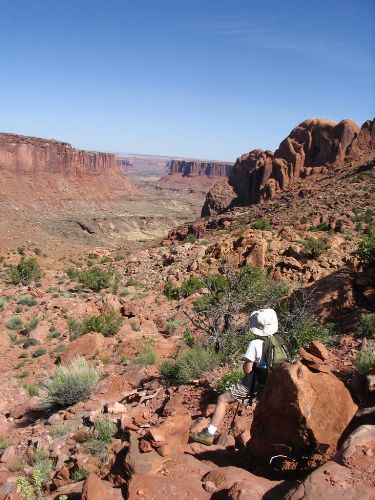
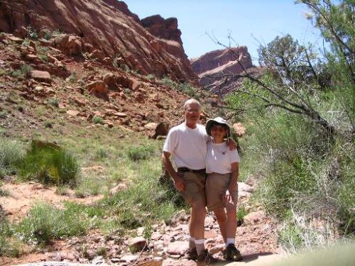
| Hike Summary: | Canyonlands National Park has three separate access areas – Island in the Sky, The Needles, and The Maze. This hike is in the Island in the Sky section. There is no drinking water in this section of the park except for bottled water from a vending machine at the visitors center. Take lots of water with you on this hike. Reservations and permits are required for backcountry camping. There is an entrance fee to get into this area of the park. The loop trail starts in the picnic area at an elevation of 5,680 feet. Follow the Upheaval Dome Overlook trail out of the parking area. You will soon reach a junction with the Syncline Loop. Turn left to begin hiking along the Southern side of the dome. This is the clockwise direction on the loop and the recommended direction to hike, though it probably doesn’t make a lot of difference – it’s a very difficult hike in either direction. The trail descends slowly then uses switchbacks as it leads westward. At the bottom of the switchbacks it follows a drainage for about 1.5 miles to a trail junction. Left goes on down into Upheaval canyon. To continue on the loop trail, turn right here. You’ll pass a primitive backcountry campsite and then begin the climb out on the North side of the dome. You will pass one of the few areas in this section of the park with water here, a riparian area. The climb out is extremely steep in places with only rock cairns to mark the trail. Returning to the Overlook trail you will have lost and regained over 1,520 feet in elevation. A very exhausting but extremely rewarding hike. |


2 replies on “Syncline Loop – Canyonlands NP - Member Hike”
The hike is truly amazing. Did it on Nov 26, 2010 clockwise. Apparently there has been a huge work done on trail improvement. The are lots of cairns, and the trail was generally easy to follow (we could have been helped by the snow which retains footprints well). Still this is a tough hike, and one has to be very careful since there are many difficult spots.
This was a great trail! There were a few guys working trail crew, so we had to dodge some falling rocks. Otherwise, it was great! There was some mad scrambling over boulders towards the end of the trail making it fun – but the reward of ending up in that riparian valley made it all worth it.