Trail: #85. Kirkland Creek - Member Hike
| Hike Name: | Trail: #85. Kirkland Creek |
|---|---|
| Country: | United States |
| State: | Tennessee |
| Nearby Town: | Tellico |
| Rating: |  |
| Directions: | From Tellico Plains, Travel south on State Hwy. 68 for approximately 5 miles and turn left onto County Hwy. 610. Travel on County Hwy. 610 for approximately 1.5 miles and turn left onto County Hwy. 623. Continue for 1.5 miles and turn right onto FDR #123. Continue for 3 miles and the trailhead will be on the right. |
| Total Hike Distance: | 4.70 miles |
| Hike Difficulty: | Moderate |
| Permit Required: | No |
| Hike Type: | In & Out, Backtrack Hike |
| Hike Starts/Ends: | Bald River |
| Trails Used: | Kirkland Creek |
| Backcountry Campsites: | Yes |
| Backcountry Water Sources: | Streams, Rivers, Springs |
| Management: | National Park Service |
| Contact Information: | http://www.telliquah.com/Trails.htm |
| Best Season: | |
| Users: | |
| Road Conditions: | Primary Paved Roads, Secondary Paved Roads |
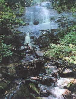
| Hike Summary: | The Kirkland Creek Trail #85 is a moderate 4.7 mile hike. The trail begins at the mouth of Kirkland Creek on Bald River Road (125) and ends at an old logging road near Sandy Gap. Roadside parking is available. |


There are no comments yet.