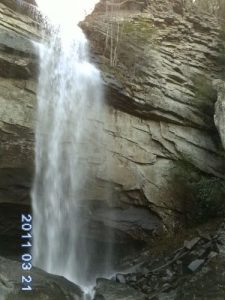
Laurel-Snow Falls - Member Hike
| Hike Name: | Laurel-Snow Falls |
|---|---|
| Country: | United States |
| State: | Tennessee |
| Nearby Town: | Dayton |
| Rating: |  |
| Directions: | Coming up from Soddy-Daisy head North on Highway 27,[ passing first through Sale Creek, then Dayton ] until you see a Walgreen and Right Aid. Take a right turn between them onto Walnut Grove Road. As you drive on Walnut you will pass a La-Z-Boy factory then just past it you will go around a curve and see a sign for Back Valley Road going to the right DO NOT TURN! KEEP GOING STRAIGHT, proceed 0.7 miles to an unmarked gravel road/Richland Creek Road (small white Baptist church on the left) and turn right. Proceed about 1 mile to the parking area at the end of Richland Creek Road. |
| Total Hike Distance: | 8.00 miles |
| Hike Difficulty: | Difficult |
| Permit Required: | Yes |
| Hike Type: | In & Out, Backtrack Hike |
| Hike Starts/Ends: | idk |
| Trails Used: | Laurel & Snow |
| Backcountry Campsites: | Yes |
| Backcountry Water Sources: | Streams |
| Management: | State Park Service |
| Contact Information: | Cumberland Trail State Park, South Trail Office, 1838 Taft Highway, Signal Mountain, phone (423) 886-2951; Division of Natural Areas – East TN Office, 3711 Middlebrook Pike, Knoxville, TN 37921, phone (865) 594-5601. Division of Natural Areas, 401 Church Street, 7th Floor L&C Annex, Nashville, TN 37243, phone (615) 532-0431 |
| Best Season: | Spring, Summer |
| Users: | Hikers, Dogs |
| Road Conditions: | Maintained Gravel or Dirt Roads, Four Wheel Drive Recommended |
| Hike Summary: | It is ok walking until you pass the first bridge where the trail splits and head to each Falls. From there the trails get steep, but it is well worth it to swim in that cold refreshing water on top of the falls. If headed to Snow Falls when you get to the over look with the power lines if you head west following them you should come across a dirt road take a right towards North go util you see a cable gate ,and about 20 feet in front of it will be the trail to Snow Falls and have save you some time.( DO NOT FOLLOW IF EASLY LOST, IT WILL BE ON YOUR PERSON IN BECOMING LOST ) Backcountry camping is by permit only, call 423-566-2229 or go to www.cumberlandtrail.org. |


There are no comments yet.