Hemphill Bald Loop- Smokies - Member Hike
| Hike Name: | Hemphill Bald Loop- Smokies |
|---|---|
| Country: | United States |
| State: | Tennessee |
| Nearby Town: | Knoxville, Gatlinburg |
| Rating: |  |
| Directions: | From Asheville, take I 40 W to US 74 W to US 19/23S through Maggie Valley, Exit onto Blue Ridge Parkway @ Soco Gap. Head N. At milepost 458.2 turn R onto Heintooga Rd. Park 6.1m later @ Polls Gap trailhead. |
| Total Hike Distance: | 13.10 miles |
| Hike Difficulty: | Difficult |
| Permit Required: | No |
| Hike Type: | Roundtrip, Loop Hike |
| Hike Starts/Ends: | Polls Gap trailhead |
| Trails Used: | Hemphill Bald Loop |
| Backcountry Campsites: | No |
| Backcountry Water Sources: | Streams |
| Management: | National Park Service |
| Contact Information: | Unknown |
| Best Season: | Winter, Spring, Summer, Fall |
| Users: | Hikers |
| Road Conditions: | Primary Paved Roads, Secondary Paved Roads |
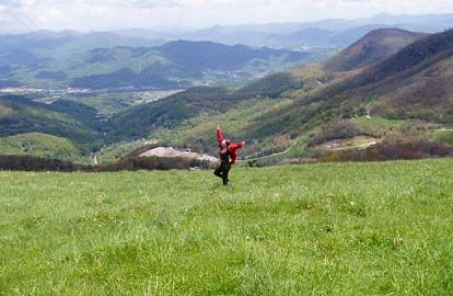
| Hike Summary: | This 13.1 mile loop is classic Smokies, free flowing creeks,wide valley views, and hardwood forests peppered with long abandoned homesites. 1. Polls Gap Trailhead: Take Hemphill Bald Trail. 2. Follow 1930's split rail fence 3. Hemphill Bald (5,540 ft) 4. Left @ Y to descend to valley. 5. Left @ Tonto Caldwell Fork Trail. 6. Cross log bridge. 7. Strt @ T. 8. L @ T. 9. Trail follows contourof Big Spruce Ridge, continue to finish loop @ Polls Gap. |


There are no comments yet.