Great Smoky Mountains - Mount Sterling - Member Hike
| Hike Name: | Great Smoky Mountains - Mount Sterling |
|---|---|
| Country: | United States |
| State: | Tennessee |
| Nearby Town: | Gatlinburg |
| Rating: |  |
| Directions: | (Big Creek Campground) – Take I-40 to Exit 451 (Waterville Road). Turn left after crossing the Pigeon River and pass a power plant on the left. Proceed 2.3 miles to a four-way intersection. Continue straight ahead and pass big Creek Ranger Station on your right. Continue on to the trailhead in the Big Creek Campground, a short distance past the ranger station. (Great Smoky Mountain National Park) – Several major highways lead to the park. The following routes provide access to the three main entrances. In Tennessee: 1)From I-40 take Exit 407 (Sevierville) to TN Route 66 South, and continue to U.S. 441 South. Follow U.S. 441 to Park. 2.) From I-40 in Knoxville - Exit 386B U.S. Highway 129 South to Alcoa/Maryville. At Maryville proceed on U.S. 321 North through Townsend. Continue straight on TN Highway 73 into the park. In North Carolina: From I-40, take U.S. Route 19 West through Maggie Valley. Proceed to U.S. 441 North at Cherokee into the park. From Atlanta and points south: follow U.S. 441 and 23 North. U.S. 441 leads to the park. |
| Total Hike Distance: | 21.70 miles |
| Hike Difficulty: | Difficult |
| Permit Required: | Yes |
| Hike Type: | Roundtrip, Loop Hike |
| Hike Starts/Ends: | Big Creek Campground |
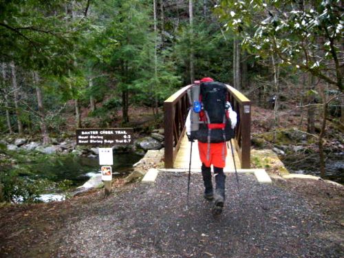
| Trails Used: | Balsam Mt, Baxter Creek, Big Creek, Gunter Fork, Mt. Sterling Ridge |
| Backcountry Campsites: | Yes |
| Backcountry Water Sources: | Streams, Rivers, Springs |
| Management: | National Park Service |
| Contact Information: | Great Smoky Mountains National Park 107 Park Headquarters Road Gatlinburg, TN 37738 (865) 436-1200 |
| Best Season: | Spring, Fall |
| Users: | Hikers, Horses |
| Road Conditions: | Primary Paved Roads, Secondary Paved Roads |
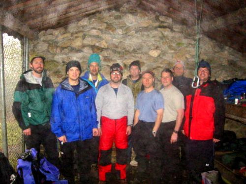
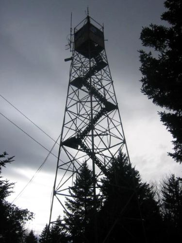
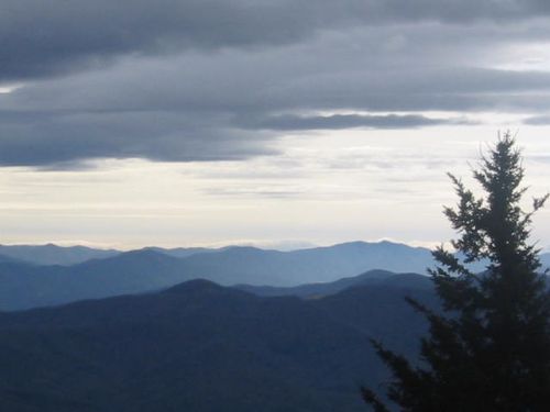
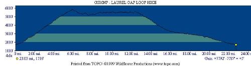
| Hike Summary: | The Great Smoky Mountains get more annual visitors than any other National Park in the U.S. Surprisingly, most people never see the backcountry which has some of the most pristine wilderness in the Southeast. The Mount Sterling hike is a 2-3 day route that starts at Big Creek Campground and follows a loop through the eastern section of the park. The hike takes you to the summit of Mount Sterling where there are outstanding views from a fire tower at the summit. The route then follows a ridge past Laurel Gap and descends to three waterfalls along Gunter Fork and Big Creek. It ends back at the parking area at Big Creek Campground. |
Recommended


Trip Reports
| Date | Rating | Duration | Hiker | |
|---|---|---|---|---|

|
January 18, 2004 |  |
1 day | BirdShooter |

|
January 16, 2004 |  |
2 days | BirdShooter |
There are no comments yet.