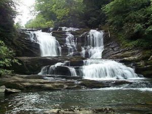
Conasauga Falls - Member Hike
| Hike Name: | Conasauga Falls |
|---|---|
| Country: | United States |
| State: | Tennessee |
| Nearby Town: | Tellico Plains |
| Rating: |  |
| Directions: | From Tellico Plains, take Hwy 68 towards Coker Creek. Talk Old State Hwy 68 vic Bakers Grave and Tellico Mtns and follow FS 341A to trailhead. LOCATION Latitude: 35.305 Longitude: -84.32861 |
| Total Hike Distance: | 1.00 miles |
| Hike Difficulty: | Moderate |
| Permit Required: | No |
| Hike Type: | In & Out, Backtrack Hike |
| Hike Starts/Ends: | 341a |
| Trails Used: | Conasauga Falls Trail |
| Backcountry Campsites: | No |
| Backcountry Water Sources: | Streams, Springs |
| Management: | U.S. Forest Service |
| Contact Information: | http://www.cs.utk.edu/~dunigan/landforms/m.php?wpt=MOF006 |
| Best Season: | Winter, Spring, Summer, Fall |
| Users: | Hikers |
| Road Conditions: | Primary Paved Roads, Secondary Paved Roads |
| Hike Summary: | Very short Hike and well worth the drive. Knock out Bald River Falls while you're at it. |


There are no comments yet.