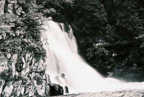
Abrams Falls Trail - Member Hike
| Hike Name: | Abrams Falls Trail |
|---|---|
| Country: | United States |
| State: | Tennessee |
| Nearby Town: | Gatlinburg |
| Rating: |  |
| Directions: | Take the Cades Cove motor loop and watch for the Abrams Falls sign halfway around. |
| Total Hike Distance: | 5.00 miles |
| Hike Difficulty: | Easy to Moderate |
| Permit Required: | No |
| Hike Type: | In & Out, Backtrack Hike |
| Hike Starts/Ends: | At trailhead |
| Trails Used: | Abrams Falls Trail |
| Backcountry Campsites: | No |
| Backcountry Water Sources: | Streams, Rivers, Springs |
| Management: | National Park Service |
| Contact Information: | Unknown |
| Best Season: | Spring, Summer, Fall |
| Users: | Hikers |
| Road Conditions: | Primary Paved Roads |
| Hike Summary: | A fairly easy hike. Trail is well maintained and mostly smooth. There are a lot of people that take this trail, and it is difficult to get photos of the falls without people in them. |


There are no comments yet.