Overland Track - Member Hike
| Hike Name: | Overland Track |
|---|---|
| Country: | Australia |
| Region: | Tasmania |
| Nearby Town: | Hobart - Launceston |
| Rating: |  |
| Directions: | The track can be started from either Lake St Clair or Cradle Mountain. Bus transport is available throughout the year from Hobart and Queenstown to Derwent Bridge (five kilometres from Lake St Clair); to Lake St Clair from Hobart; to Cradle Mountain from Launceston and Devonport; and from November to April to Lake St Clair from Launceston and Devonport |
| Total Hike Distance: | 90.00 kilometers |
| Hike Difficulty: | Moderate to Difficult |
| Permit Required: | Yes |
| Hike Type: | One-Way, Shuttle Hike |
| Hike Starts: | Craddle Mountain |
| Hike Ends: | Lake St. Clair |
| Trails Used: | ALL |
| Backcountry Campsites: | Yes |
| Backcountry Water Sources: | Streams, Rivers, Lakes, Springs |
| Management: | National Park Service |
| Contact Information: | http://www.parks.tas.gov.au/recreation/tracknotes/overland.html For more information Cradle Mountain PO Box 20 SHEFFIELD TAS 7306 Phone:03 6492 1133 Fax:03 6492 1120 Lake St Clair Lake St Clair National Park DERWENT BRIDGE TAS 7140 Phone:03 6289 1172 Fax:03 6289 1227 |
| Best Season: | Spring, Fall |
| Users: | Hikers |
| Road Conditions: | |
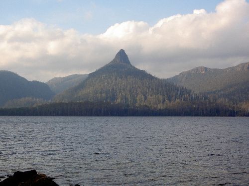
| Hike Summary: | The Overland Track runs for 80 kilometres through the heart of the Tasmanian Wilderness World Heritage Area. The Overland Track each year attracts 8000-9000 walkers from both around Australia and overseas. Waterfalls framed by fagus along the Overland Track While easier access, improved track conditions and modern outdoor equipment have all made the trip far easier than it was in yesteryear, the walk still demands a fair degree of preparation and physical fitness. The Overland Track takes 6-10 days to walk depending on weather delays and the side trips you take. |


There are no comments yet.