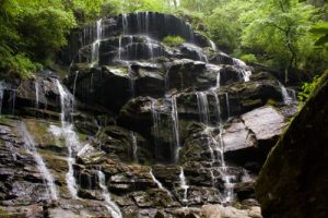
Yellow Branch Falls - Member Hike
| Hike Name: | Yellow Branch Falls |
|---|---|
| Country: | United States |
| State: | South Carolina |
| Nearby Town: | Walhalla |
| Rating: |  |
| Directions: | From Walhalla take Hwy. 28 north for six miles to Yellow Branch Picnic Area on the left just before Stumphouse Tunnel. |
| Total Hike Distance: | 3.00 miles |
| Hike Difficulty: | Easy to Moderate |
| Permit Required: | No |
| Hike Type: | In & Out, Backtrack Hike |
| Hike Starts/Ends: | Yellow Branch |
| Trails Used: | Yellow Branch |
| Backcountry Campsites: | No |
| Backcountry Water Sources: | Streams |
| Management: | State Park Service |
| Contact Information: | Unknown |
| Best Season: | Spring, Summer, Fall |
| Users: | Hikers |
| Road Conditions: | Primary Paved Roads |
| Hike Summary: | A short hike to one of the area's best waterfalls. Yellow Branch stands over 50 feet high and 75 feet wide. Go when there is a good waterflow and you'll be delighted. |


 Trail Map For This Area
There are no comments yet.