Yellow Branch Falls - Member Hike
| Hike Name: | Yellow Branch Falls |
|---|---|
| Country: | United States |
| State: | South Carolina |
| Nearby Town: | Wahalla |
| Rating: |  |
| Directions: | From Walhalla, drive west 6.8 miles on SC Highway 28 and turn left into Yellow Branch Picnic Area. (Immediately across from the Issaqueena Falls entrance). After you turn off SC 28, stay straight and do not turn right on the road going uphill. Follow the road until it deadends in a circular parking lot. The trail starts on the side opposite the portajohn. Look for the bulletin board describing the trail to the falls. |
| Total Hike Distance: | 3.00 miles |
| Hike Difficulty: | Easy to Moderate |
| Permit Required: | No |
| Hike Type: | In & Out, Backtrack Hike |
| Hike Starts/Ends: | Yellow Branch Picnic Area |
| Trails Used: | Yellow Branch Nature Trail to Yellow Branch Falls trail |
| Backcountry Campsites: | No |
| Backcountry Water Sources: | Streams |
| Management: | U.S. Forest Service |
| Contact Information: | Sumter National Forest, Andrew Pickens Ranger District, 112 Andrew Pickens Circle, Mountain Rest, SC, 29664. Telephone: 864-638-9568. |
| Best Season: | Spring, Fall |
| Users: | Hikers, Dogs |
| Road Conditions: | Primary Paved Roads |
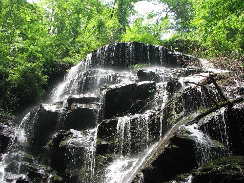
| Hike Summary: | The hike begins at the picnic area along the Yellow Branch Nature Trail. (The nature trail is a .4 mile loop so you can go in either direction.) Approx .2 miles along the nature trail you will see a sign for the Yellow Branch Falls (YB Falls), make this turn for a 1.3 mile hike to a beautiful 50-foot vertical waterfall with many individual cascades. |
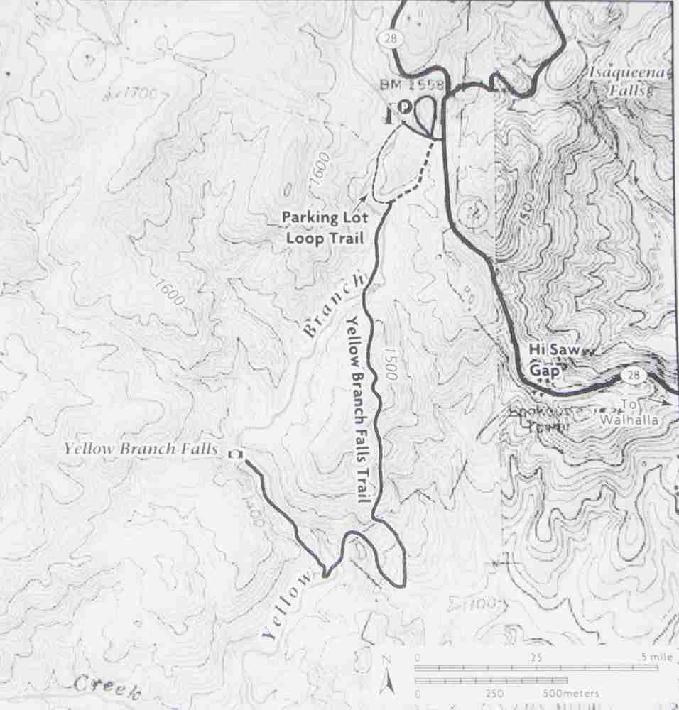

 Trail Map For This Area
One reply on “Yellow Branch Falls - Member Hike”
Yellow Creek Falls is an awesome place. I swear I took the exact same photo you did about three years ago when I visited. Glad to know it hasn’t changed.